Itinerary:
DAY 1-2 - flight from Prague to Bishkek via Istanbul, Ala Archa National Park
DAY 3 - Ala Archa National Park - trail to Ratsek Hut
DAY 4 - Ala Archa National Park - from Ratsek Hut back to the valley
DAY 5 - Issyk Kul Lake, Kara-Kul Lake
DAY 6 - Fairytale Canyon, Djety-Oguz Valley - Seven Bulls rock formation, Boris Yeltsin Peak
DAY 7 - Djety-Oguz Valley - Seven Bulls rock formation, Karakol - Dungan Mosque, market
DAY 8 - Karakol Valley - trail to Ontor Glacier
DAY 9 - Karakol Valley - trail to Ontor Glacier and back to the valley
DAY 10 - Karakol zoo, Jyrgalan village
DAY 11 - Karakol, Chon-Ashu Pass, Echkilitash
DAY 12 - trail to Tyuz Pass and Pik Vit (first part)
DAY 13 - trail to Tyuz Pass and Pik Vit (second part)
DAY 14 - trail to Tyuz Pass and Pik Vit (third part)
DAY 15-16 - Karakol, travelling to Bishkek
DAY 17 - flight from Bishkek to Prague via Istanbul
DAY 1-2 - flight from Prague to Bishkek via Istanbul, Ala Archa National Park
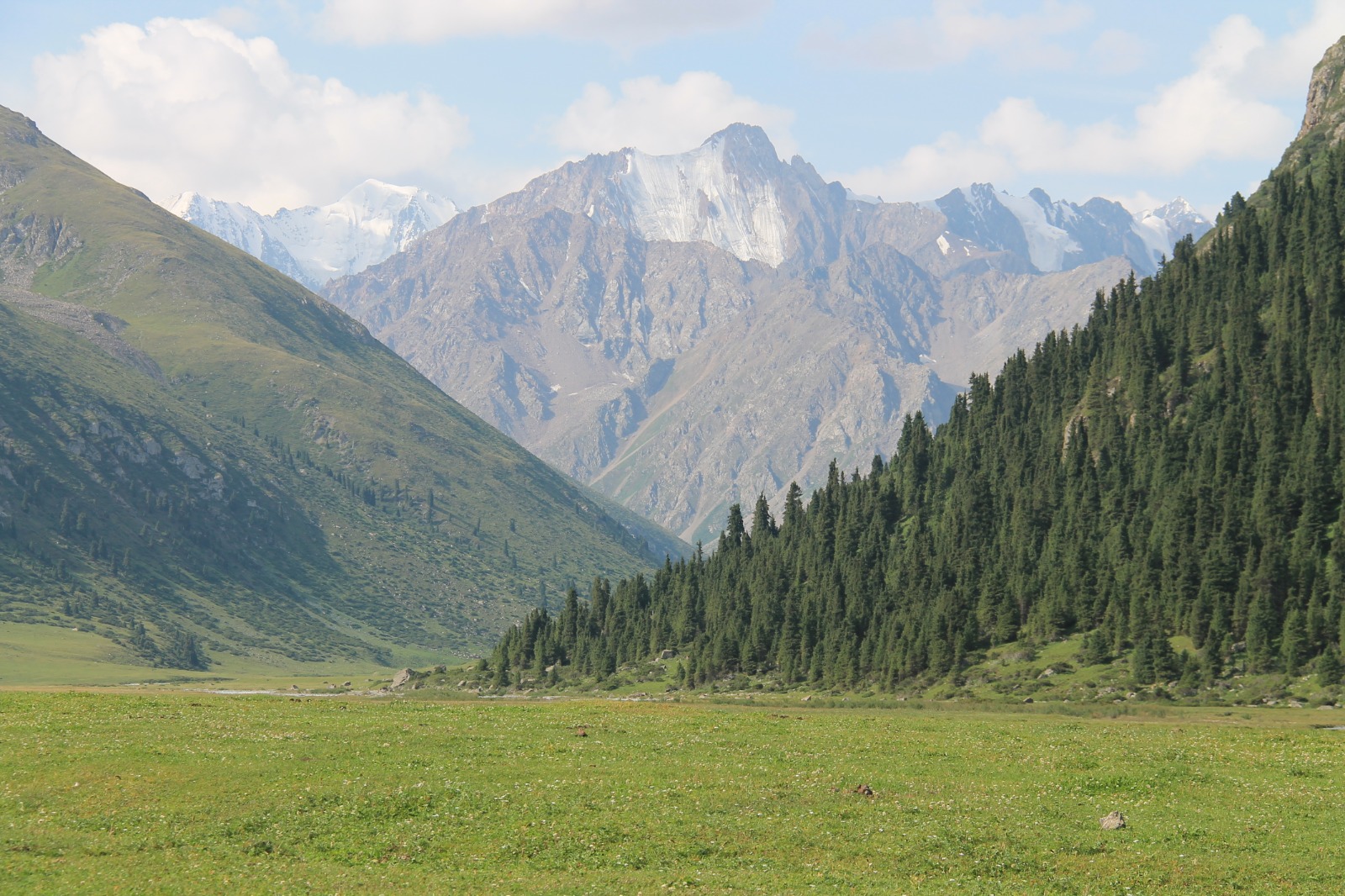
Our next adventure led us to Kyrgyzstan - country in Central Asia that is known for its beautiful nature and high mountains. The Tian Shian mountains (the Mountains of Heaven) covers over 80% of the country, so it is paradise for mountain lovers. The mountain range reaches up to 7 000 metres. The highest mountain of Kyrgyzstan is Jengish Chokusu (or Pik Pobedy) with 7 439 metres. So it was higher level even if we compare it with Great Caucasus in Georgia we have visited recently.
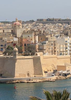
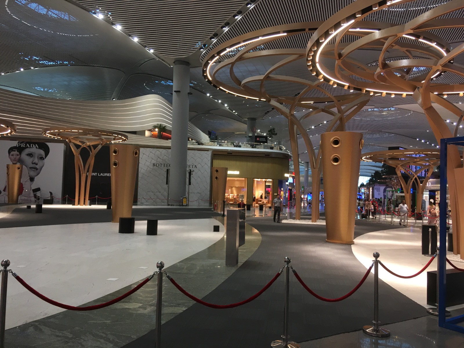
The easiest way how to get from Prague to the capital of Kyrgyzstan Bishkek was flying with Turkish Airlines via Istanbul. In Istanbul we had some time to explore brand new airport that operates international flights since May 2019.
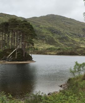
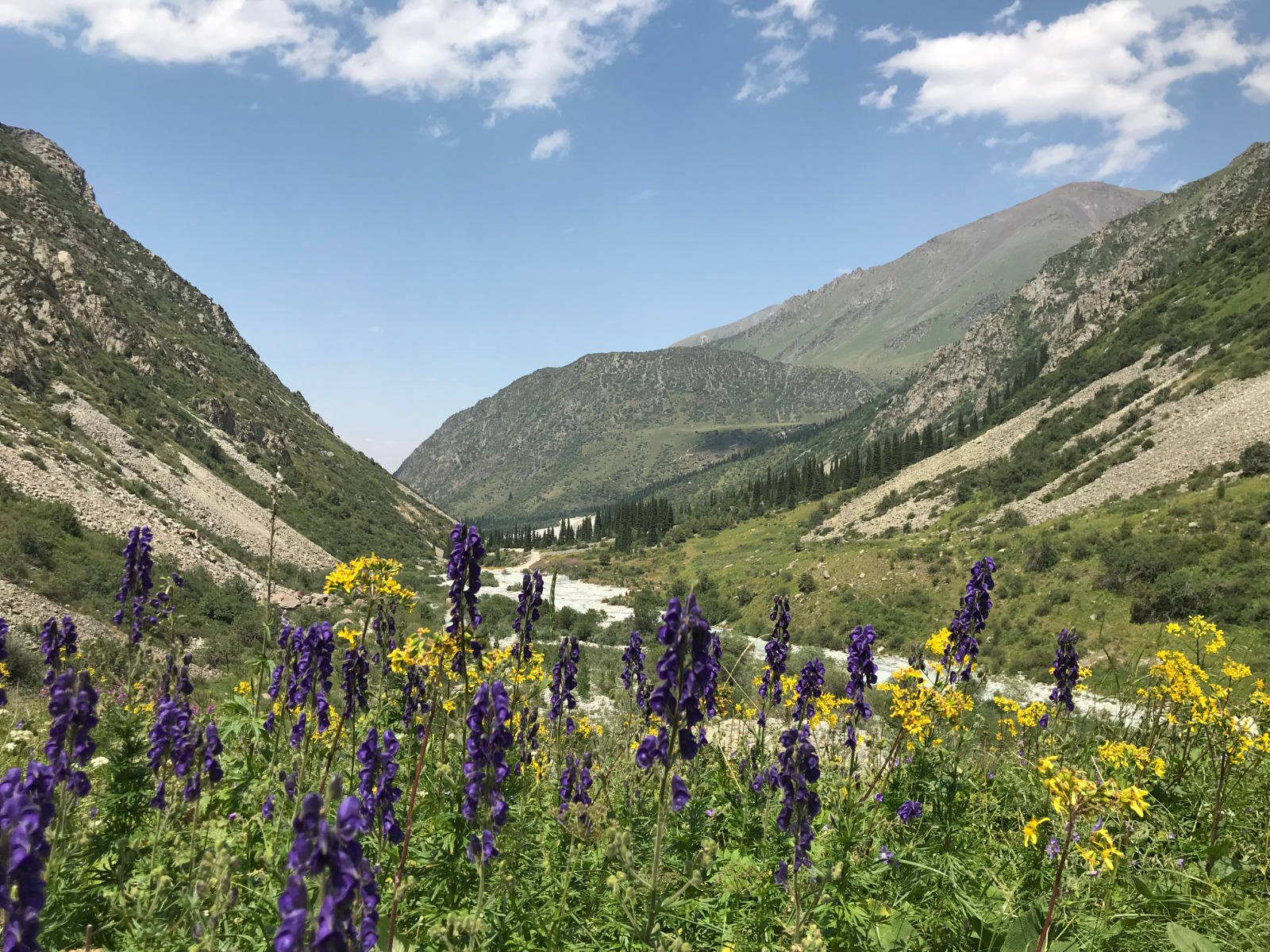
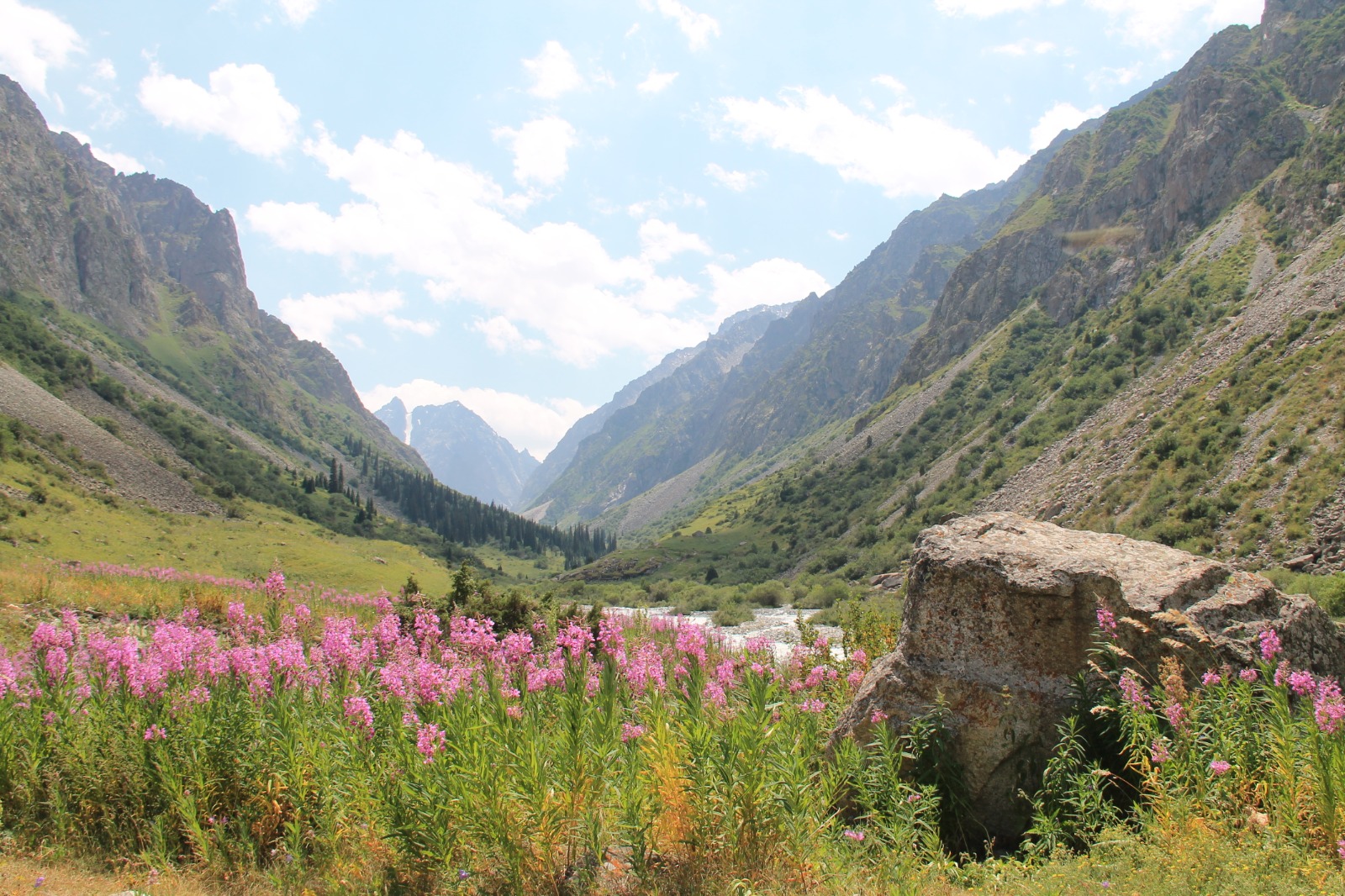
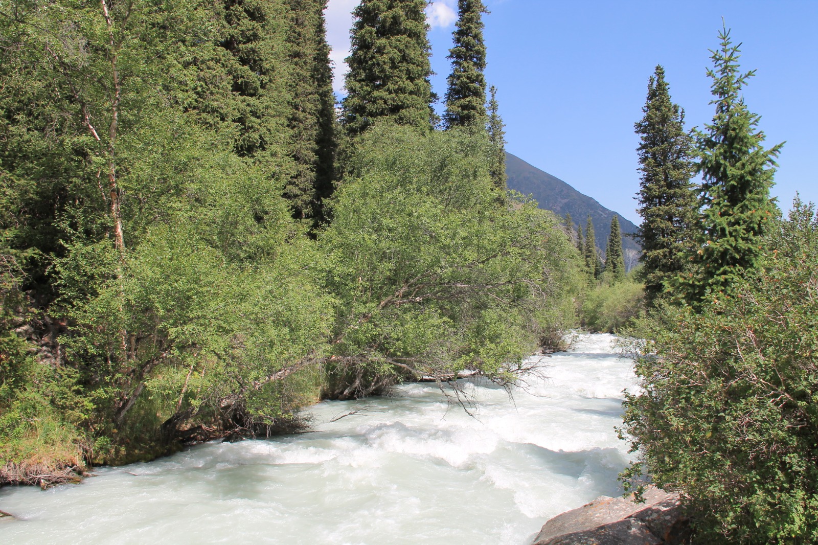
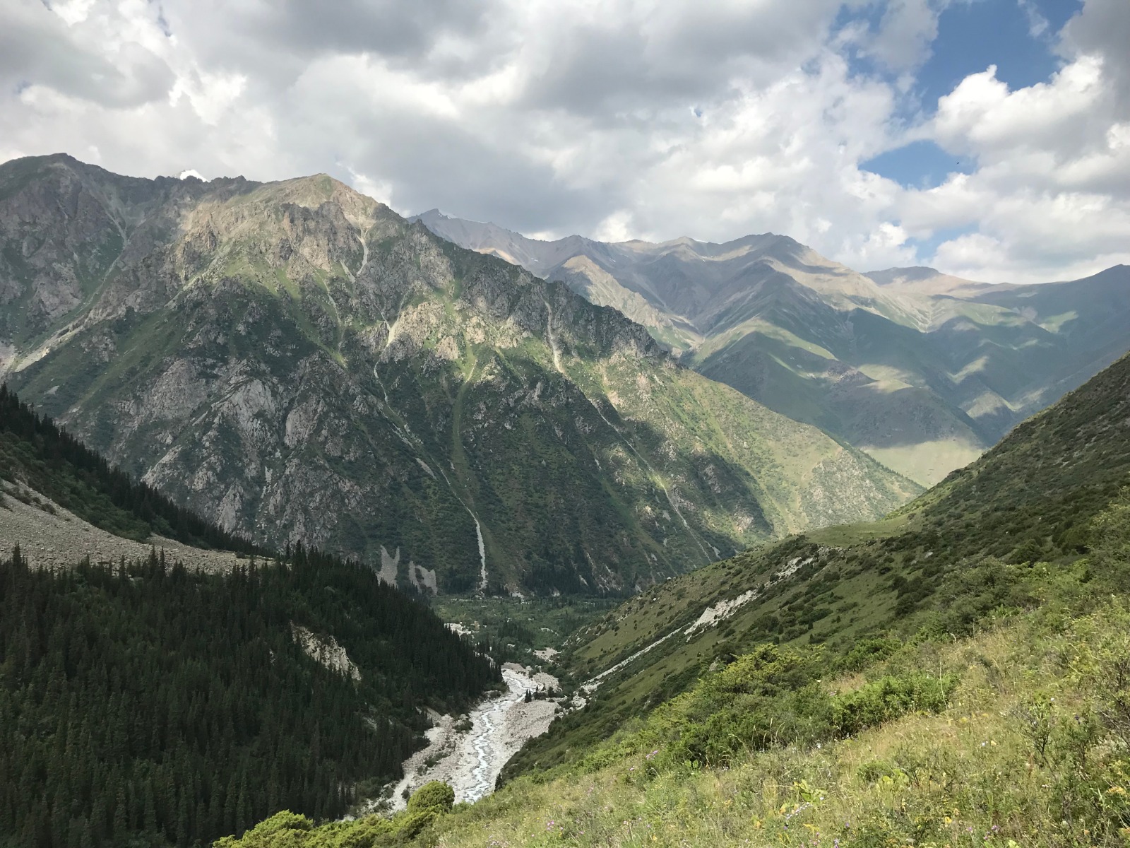
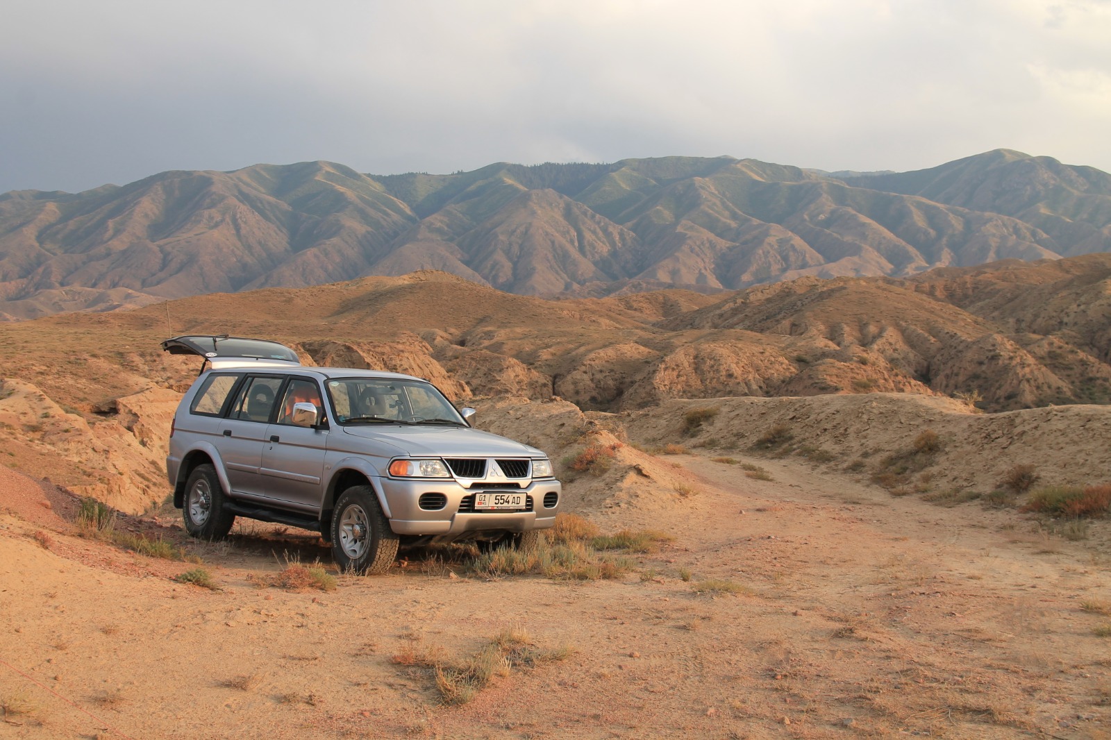
We arrived to Bishkek early in the morning, picked up our rental Mitsubishi Pajero, exchanged money and bought some food for next days that we were about to spend in the mountains. Our first destination in Kyrgyzstan was Ala Archa National Park that lies around one hour of driving from the centre of Bishkek. It was also our first encounter with crazy driving that we had to get used to in order to survive. We had to pay small fee at the entrance to get into the park. We were pretty tired after the flight, so we spent the day just hanging out around, taking photos, napping and exploring the valley of Ala Archa a little bit. It is named after majestic tall trees that are present everywhere around and we set up our first camp below its branches.
DAY 3 - Ala Archa National Park - trail to Ratsek Hut
Our target for today was camp at Ratsek Hut (3 400 metres) where we wanted to spend the night in order to get acclimatization for higher altitudes. We were ascending via Ak-Sai Valley leaving first of 1 200 height metres behind. We encountered Samat on our way up to the hut. He was Kyrgyz man who was living in Prague for 10 years and was speaking perfect Czech. He was heading to waterfall that lies half way between start of the trail and Ratsek Hut.
The second half of the trail was more steep and full of stones and brash. We crossed height of 3 000 metres soon after leaving waterfall behind. Then we were ascending long panoramic ridge that led us to Ratsek Hut. View from the ridge were superb: Ak-Sai glacier, Ratsek Hut with the camp that looked kind of like one of the base camps from Himalayas and snow-capped peaks with the height of almost 5 000 metres all around. It took us around 6 hours of walking to reach the hut. We had a headache from the height, but we got short nap and took a pill which helped us a lot. Setting our camp took us more time than usual because our head was spinning a little from all getting up and down.
The night was rough. Big storm came with raining and hailing, so we couldn't sleep.
DAY 4 - Ala Archa National Park - from Ratsek Hut back to the valley
It was raining until 10 a.m., so we were resting in our tent waiting for better weather. Our plan was trying to climb Pik Utchitel (4 545 metres), but weather was against us. We saw group of Koreans setting off quite early that returned after 2 hours, so they had to give up their climb as well. We enjoyed last outlooks of surrounding scenery, packed our stuff and started to descend back to the valley. It took us around 3.5 hours to get back to our car. We were quite tired and we decided to build our camp at the same place as during the first night we spent in Ala Archa National Park.
It was Sunday, so a lot of locals were around having picnics in order to escape from hot weather in Biskhek. One of the families invited us to join their picnic. We couldn't refuse and spent very pleasant time with them. They offered us a lot of food and we were trying to make small talk with them in combination of Czech-Russian-English language. They were very hospitable and invited us for night to their home in Biskhek, but we didn't want to bother them, so we refused and spent the night outside in the nature.
DAY 5 - Issyk Kul Lake, Kara-Kul Lake
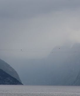
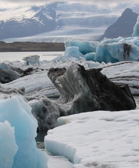
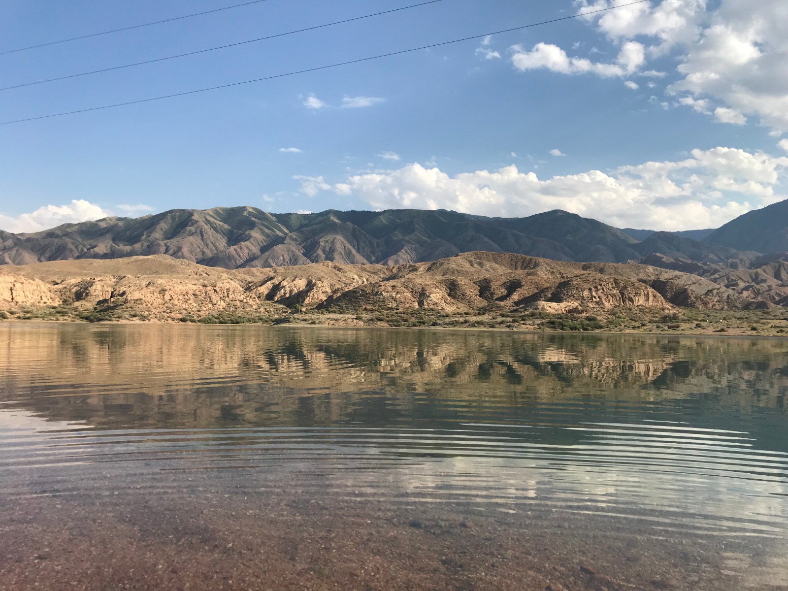
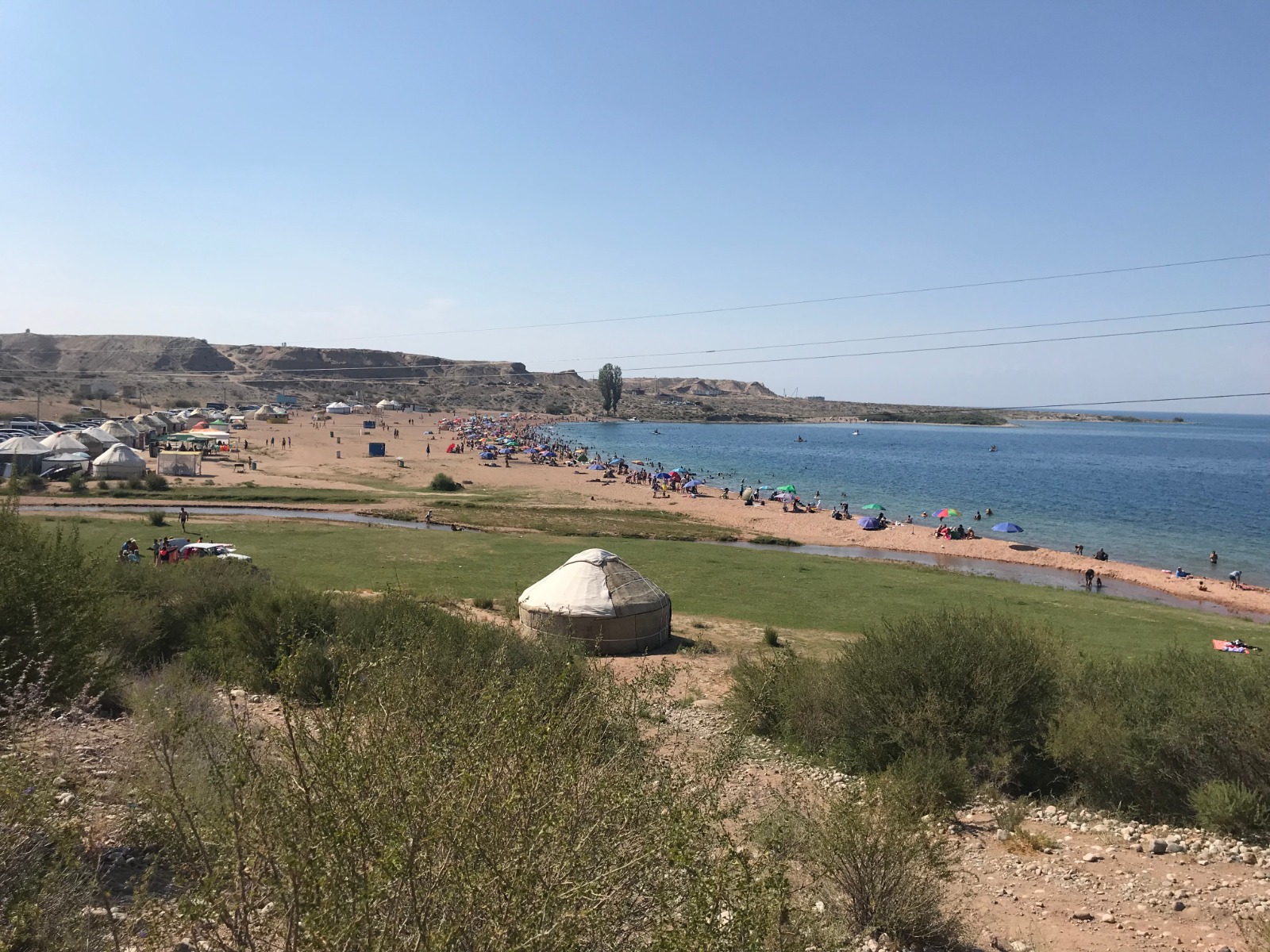
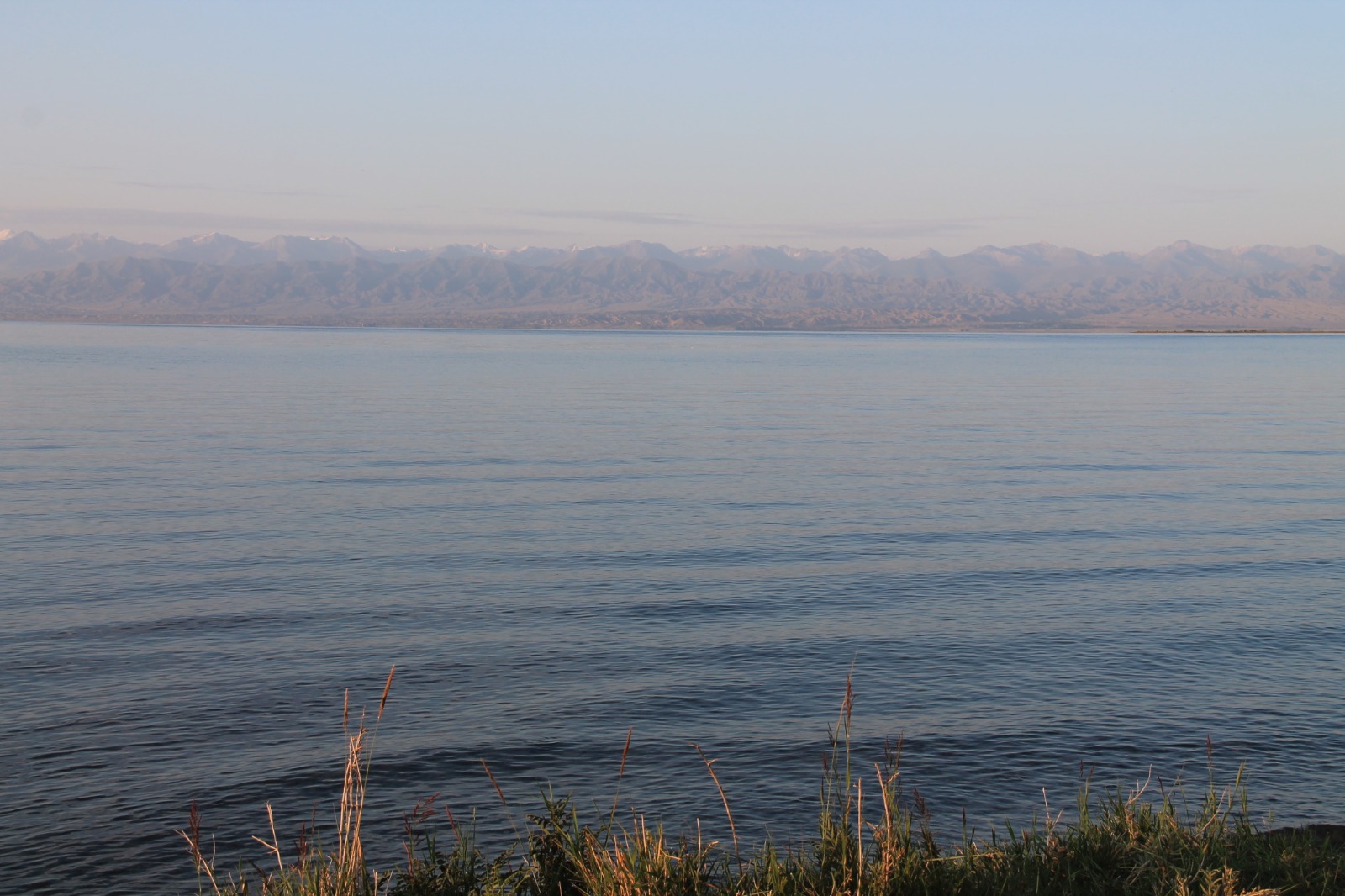
We had great breakfast with pancakes from our picnic. After that we were heading towards Issyk-Kul Lake. Issyk-Kul means "warm lake" and it never freezes. It is the second-largest mountain lake in the world behind Lake Titicaca. North part of the lake became very popular vacation resort especially for Russian and Kazakh tourists. South part of the lake is not that populated and there are no resorts.
We were driving along Kazakh borders on our way from Biskhkek to south part of the lake. It is arid semidesert area. We stopped at first beach we saw and had a bath after couple of days in the mountains. Water was very refreshing in hot weather. Generally summer is very hot in Kyrgyzstan. In order to avoid the heat you have to go high to the mountains.
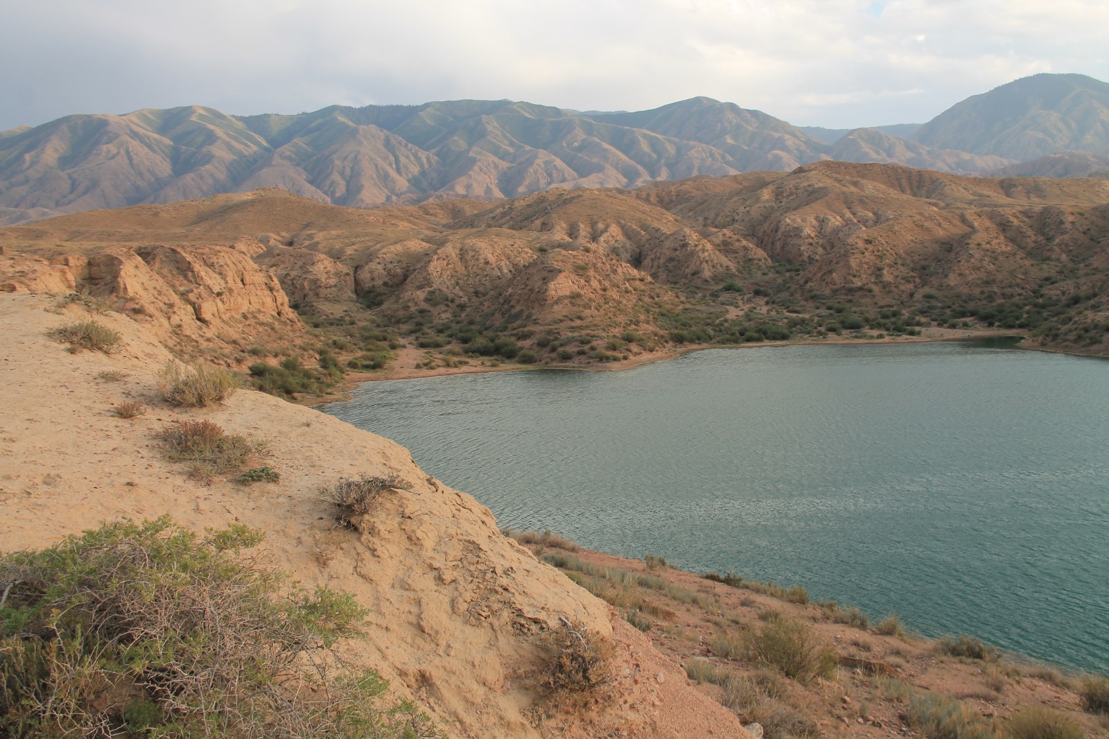
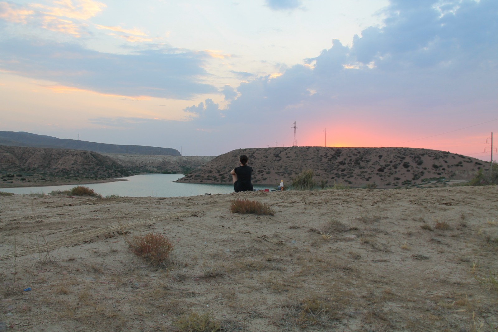
We continued to Kara-Kul Lake. It is small lake with amazing arid mountains all around. We set up our camp at the small hill right above the lake and enjoyed nice sunset. Before that we helped local family with their car. The battery of their car discharged, so we used cabels from our car to help them.
DAY 6 - Fairytale Canyon, Djety-Oguz Valley - Seven Bulls rock formation, Boris Yeltsin Peak
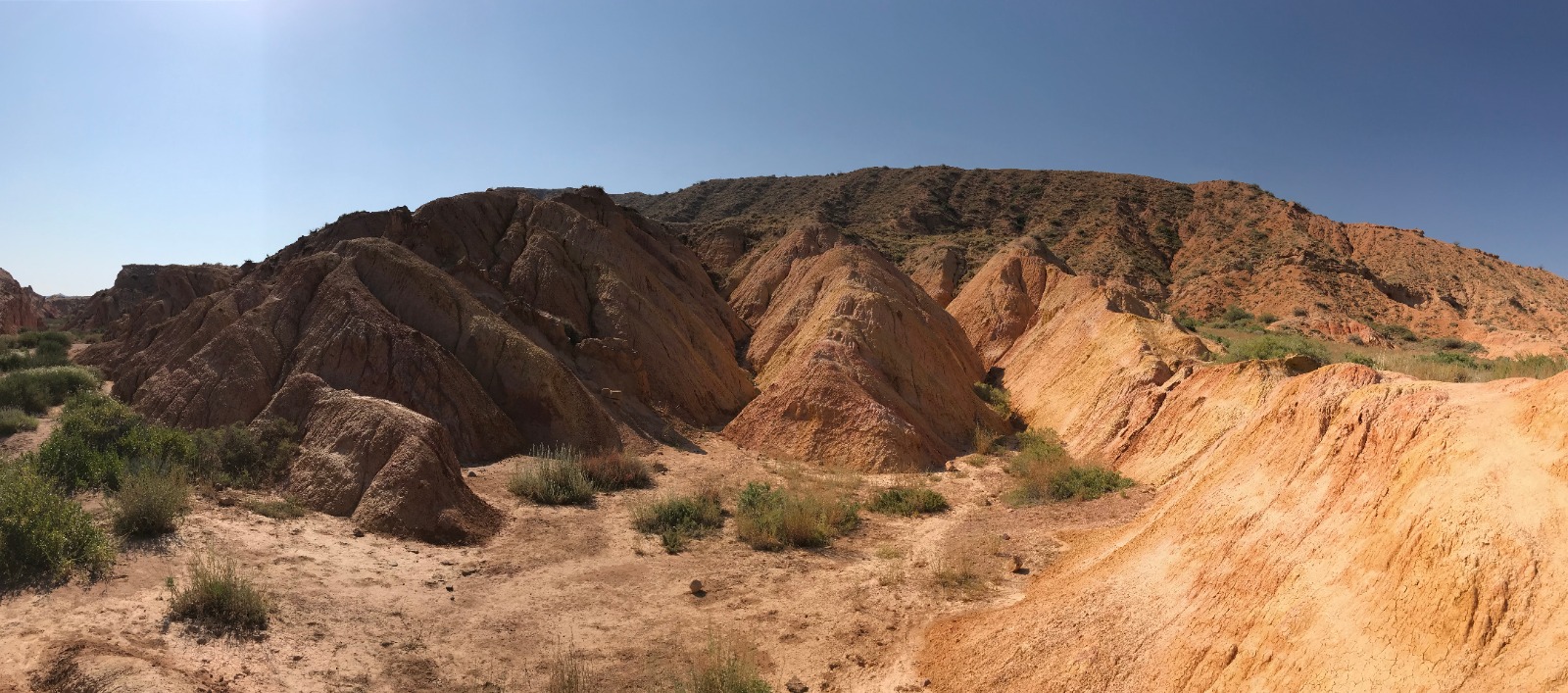
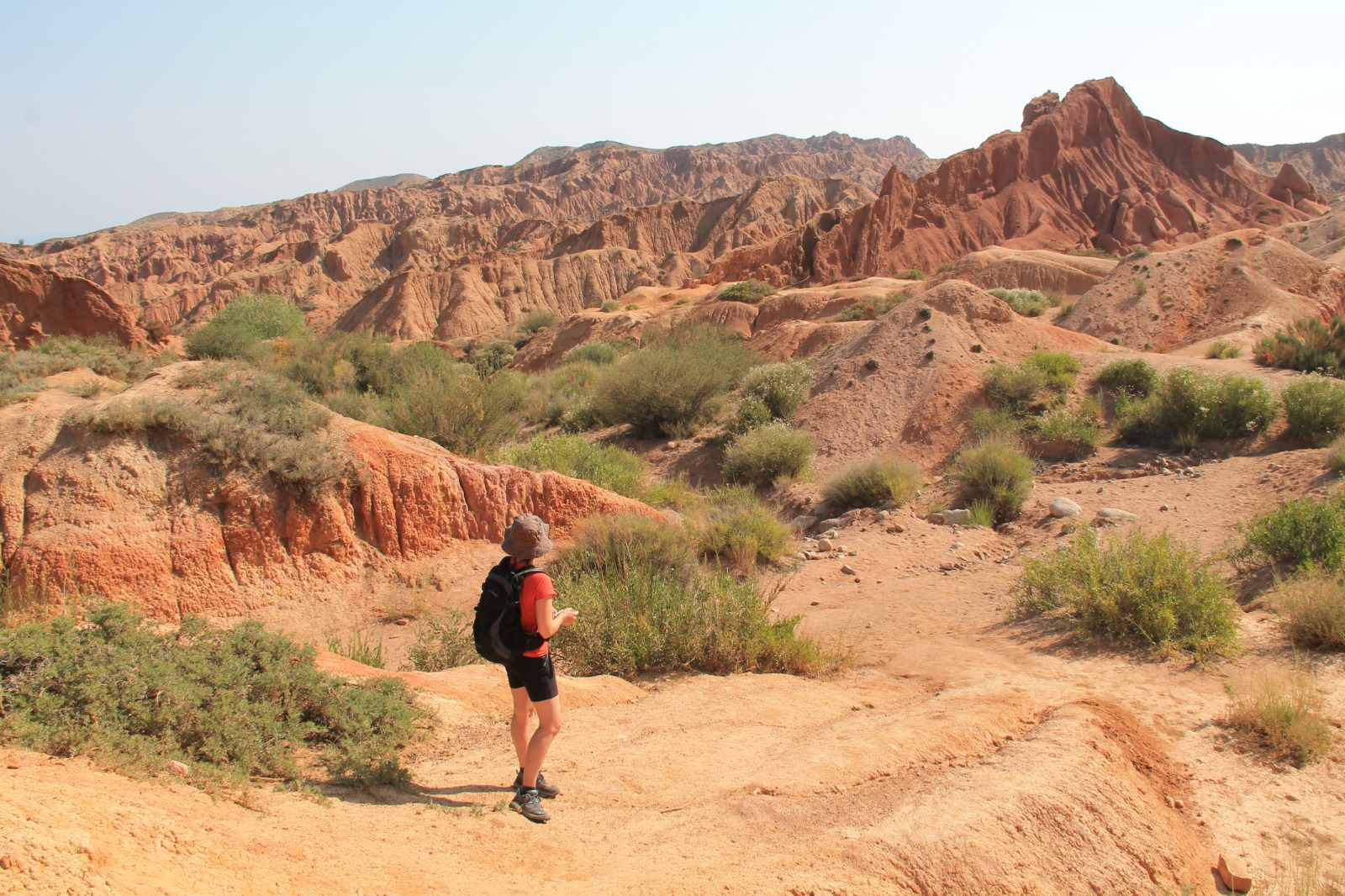
Our next stop lied very close Kara-Kul Lake. The area is called Skazka (Fairytale) Canyon. We felt like in the middle of desert. It was very hot even in the morning. Canyon is often reffered as smaller version of Grand Canyon in USA. It is popular for its pointy rocks and many others shapes of rock formations. The valley is dry and rocks vary in colour from yellow to red.
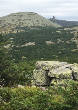
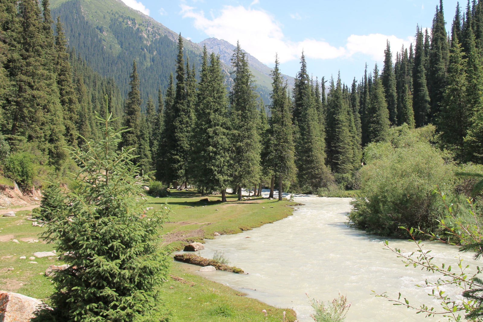
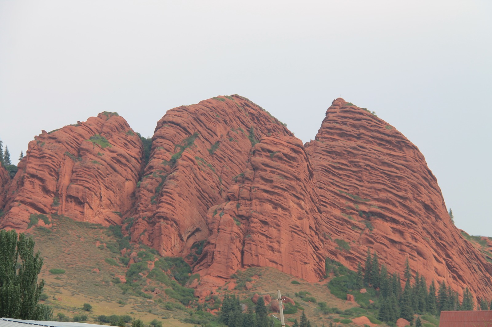
Djety-Oguz is valley around 100 kilometres from Fairytale Canyon. There are red rock formations at the beginning of the valley that are called Seven Bulls. When we continued deeper in, the road turned into first offroad of our trip. We even had to cross several wooden bridges that didn't seem as solid as we would have wished. Yurt camp in the middle of pastures seemed like good place for parking our car and we went on foot afterwards.
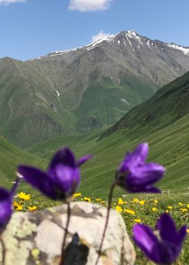
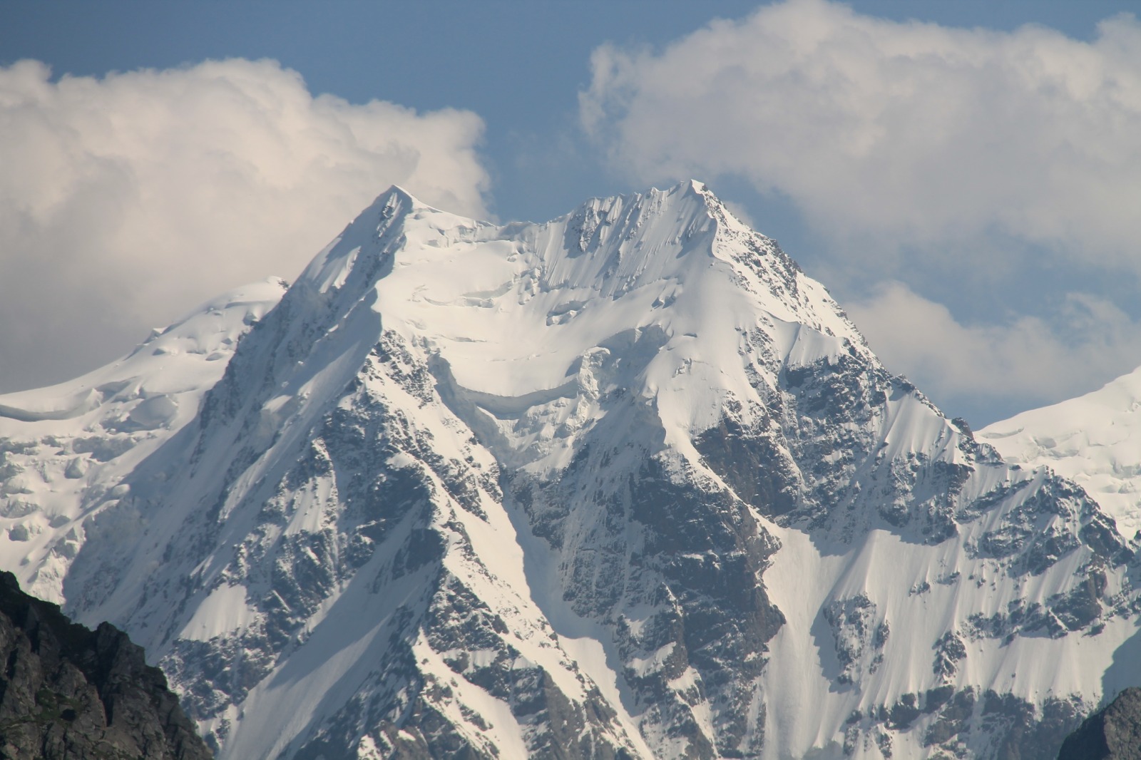
It was around 3.5 kilometres of walking to our destination which was Poljana Cvetkov (Valley of Flowers). It was amazing trail alongside glacial river. There were a lot of charming green secluded places and postcard-like views on the way. Magnificent look at Boris Yeltsin Peak (5 168 metres) was waiting for us at the end of our path. That was why we came to this place.
DAY 7 - Djety-Oguz Valley - Seven Bulls rock formation, Karakol - Dungan Mosque, market
We enjoyed another offroad on the way back from Djety-Oguz Valley. We stopped at the beginning of the valley to take a picture of Seven Bulls rock formation. The rock formation is a well-known landmark in Kyrgyzstan and is seen as a national or regional symbol.
We continued to the capital of this area - Karakol. We were looking forward to have some proper meal in the restaurant. We chose restaurant called Altyn Kumara that was serving local meals. We ordered delicious beshbarmak (boiled meat mixed with boiled noodles and bozo langman (fried noodles with meat and vegetables).
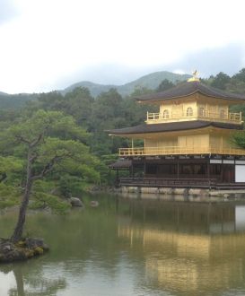
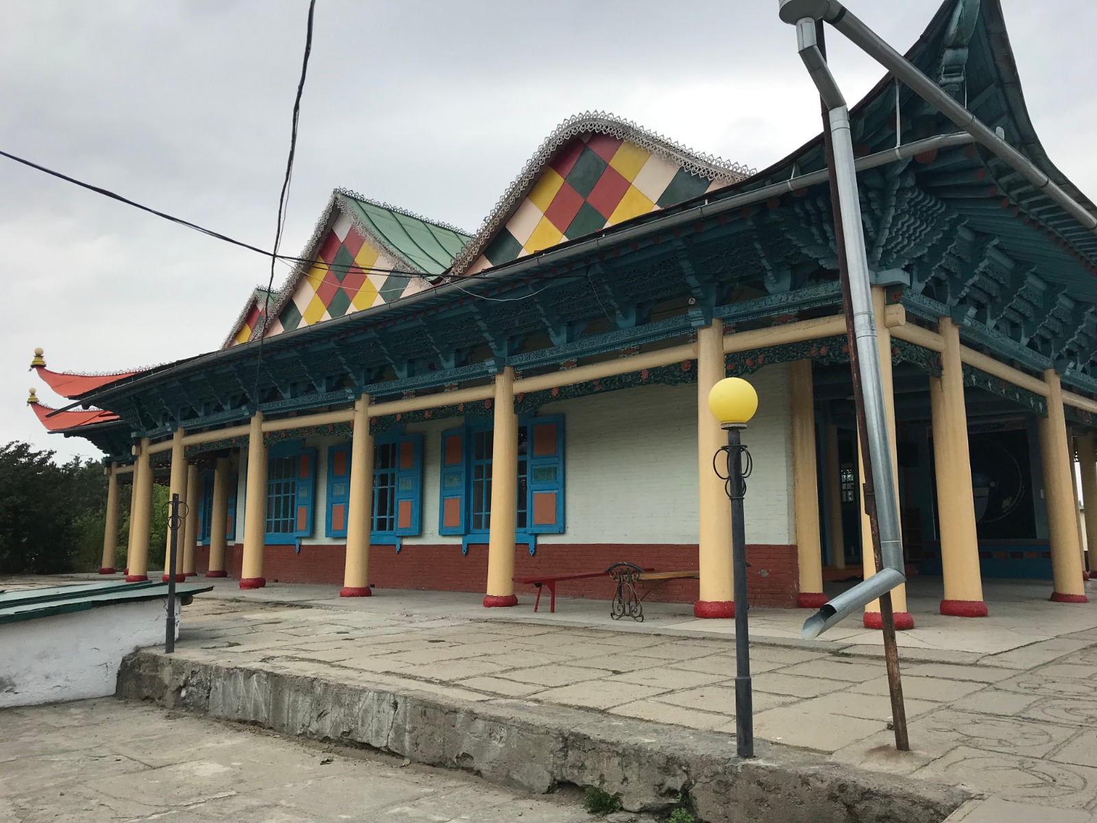
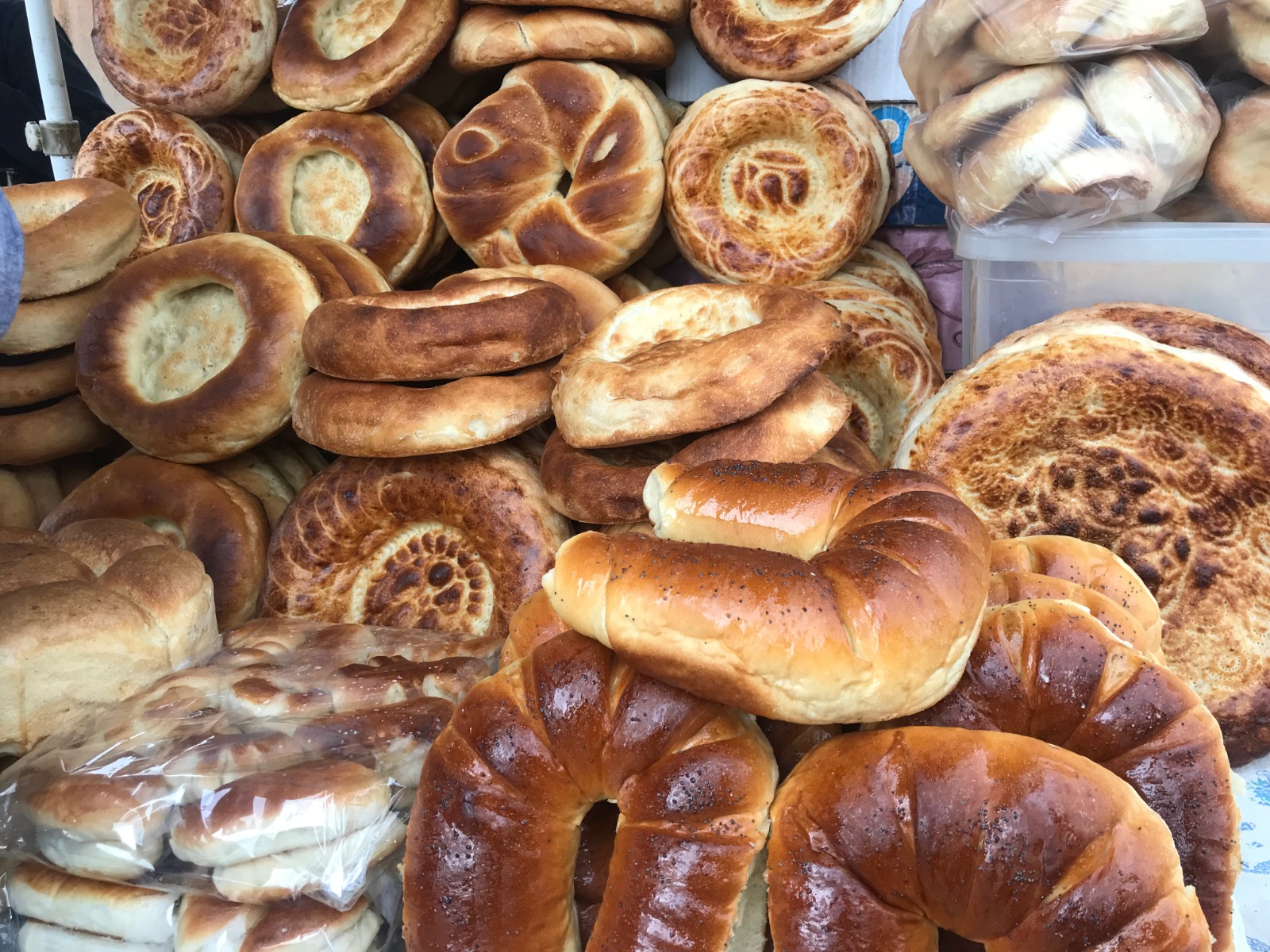
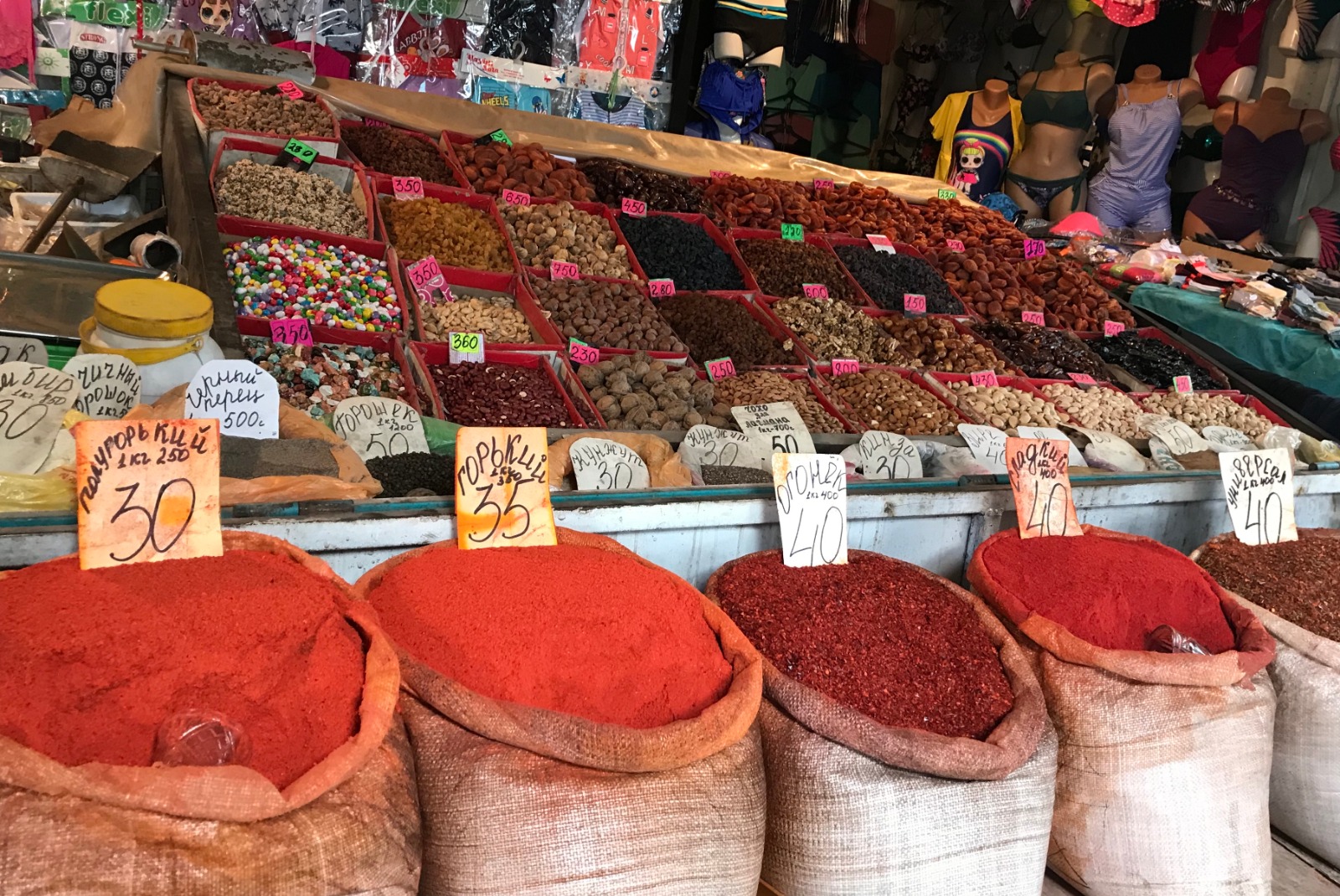
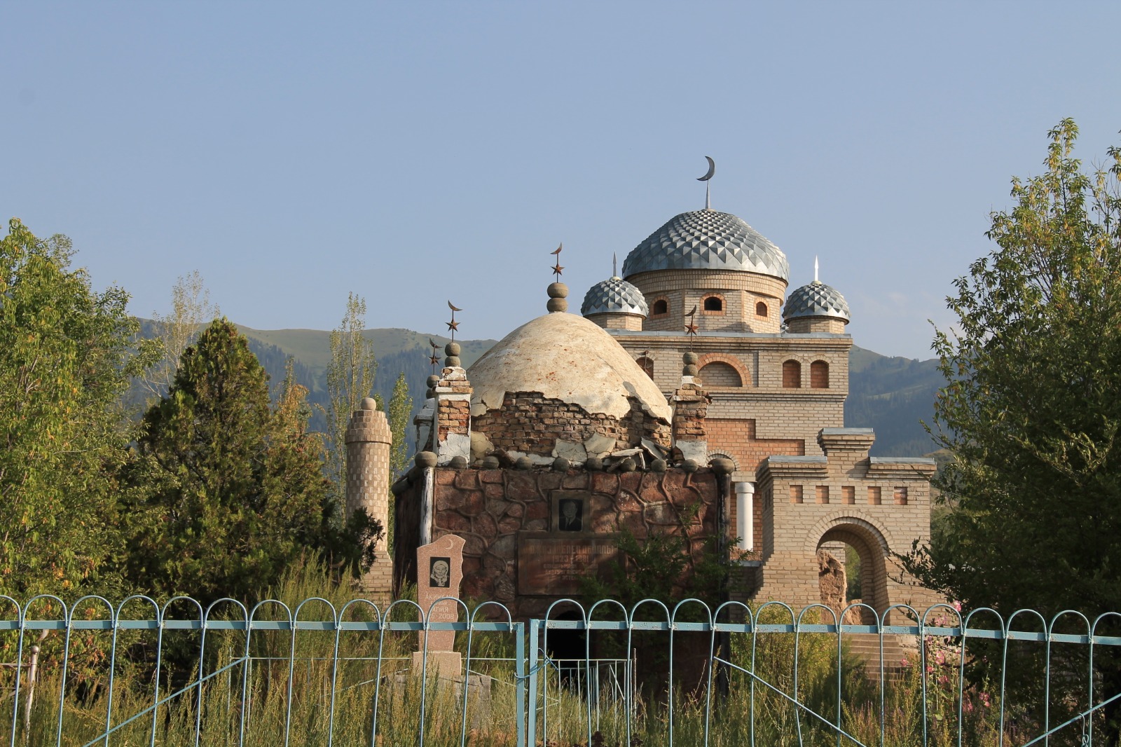
Satisfied and with full bellies we wanted to see Dungan Mosque. It is kind of odd building - something between buddhist temple and mosque. After this quiet place, market in Karakol was more lively and it was hard not to get lost in the maze of containers full of clothes, shoes and other stuff. We were expecting more of food, spices and local products, so this was a little dissapointment.
Our mood got better after visiting Lighthouse Karakol which is café whose design doesn't really belong to Karakol. It is tastefully decorated space that serves (as its name suggests) as lighthouse for foreign travellers and their coffee is very good as well. You can also buy some local products like honey or tea there.
It was first night out of our tent in normal bed in Karakol...
DAY 8 - Karakol Valley - trail to Ontor Glacier
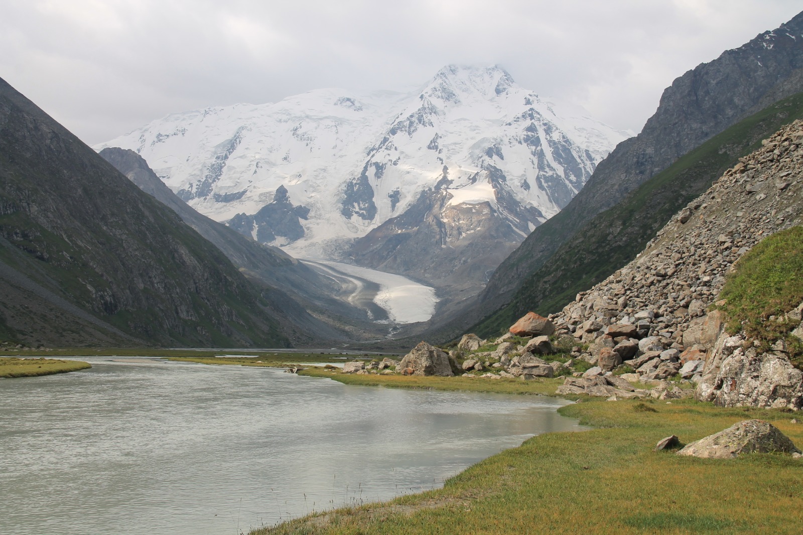
We wanted to visit area of Engilchek Glacier that lies close to Chinese border. You need special permit that allows you to explore this part of Kyrgyzstan. Agency Visit Karakol was supposed to arrange it for us. Unfortunately they had some problems with Kyrgyz offices, so the permit was not ready yet. Ibraim from Visit Karakol was very helpful and recommended us 2-days trail to Ontor Glacier in Karakol Valley and he was hoping that permit will be ready after that.
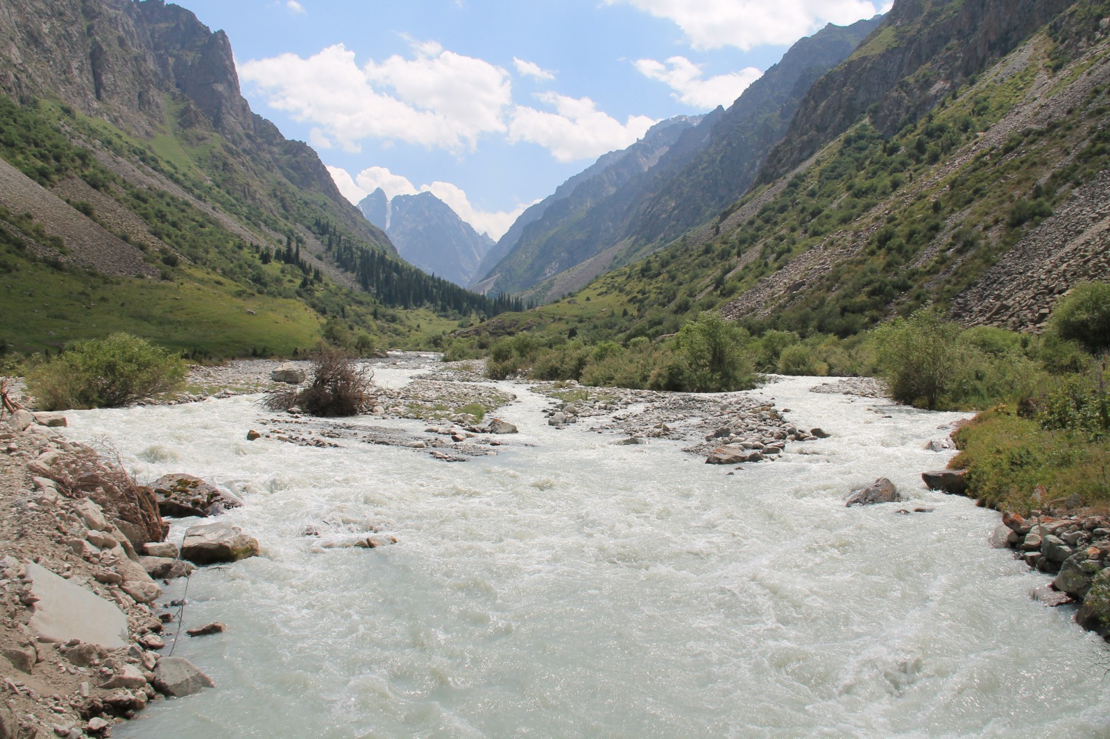
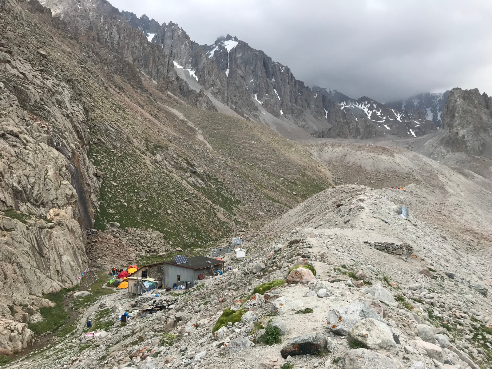
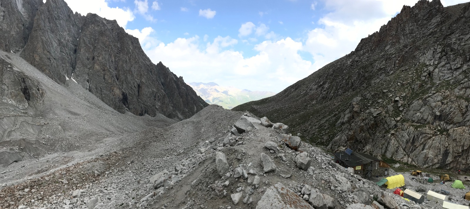
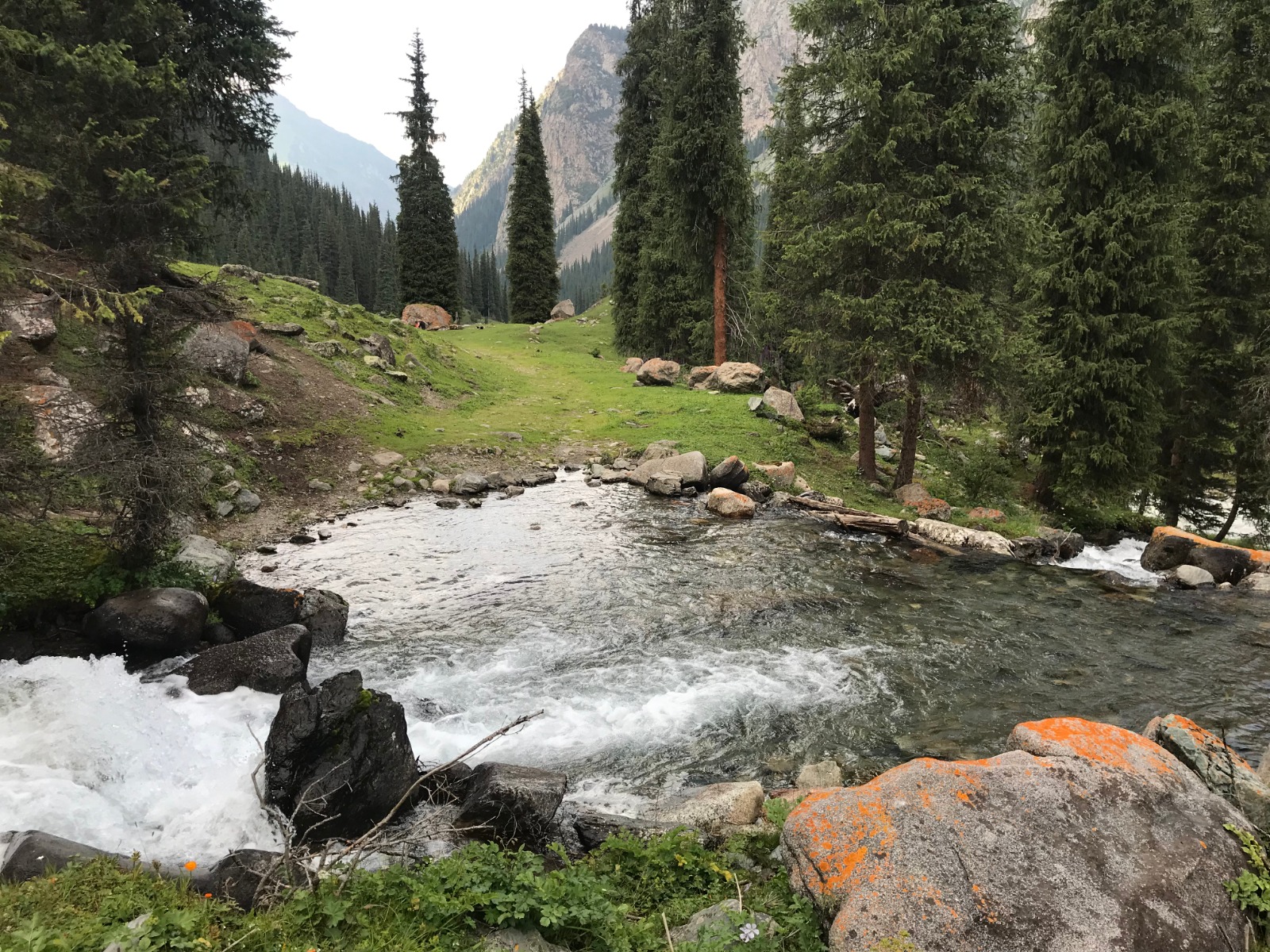
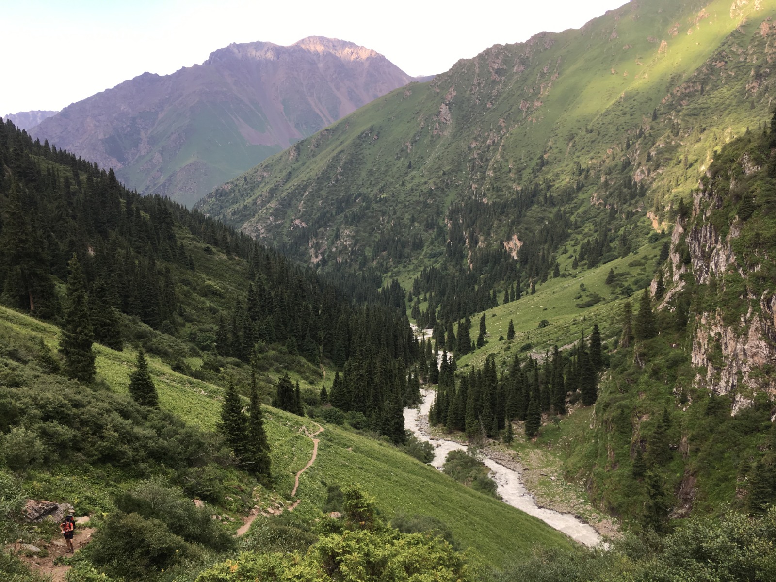
We jumped into our car that took us to the bridge being the last place that ordinary vehicles could get to. From there we had to walk. It was quite late (around 13:30) to begin the trail and we had to walk 10 kilometres to yurt camp that serves as a base camp of this area and then another at least 8 kilometres. We knew that if we hadn't stop a car to take as to the base camp, we wouldn't have been able to finish this trail in 2 days. Lucky for us after 5 kilometres of walking we managed to stop UAZ with locals that took us for small price to the base camp. Shaky and bumpy road with two laughing guys was unforgettable experience.
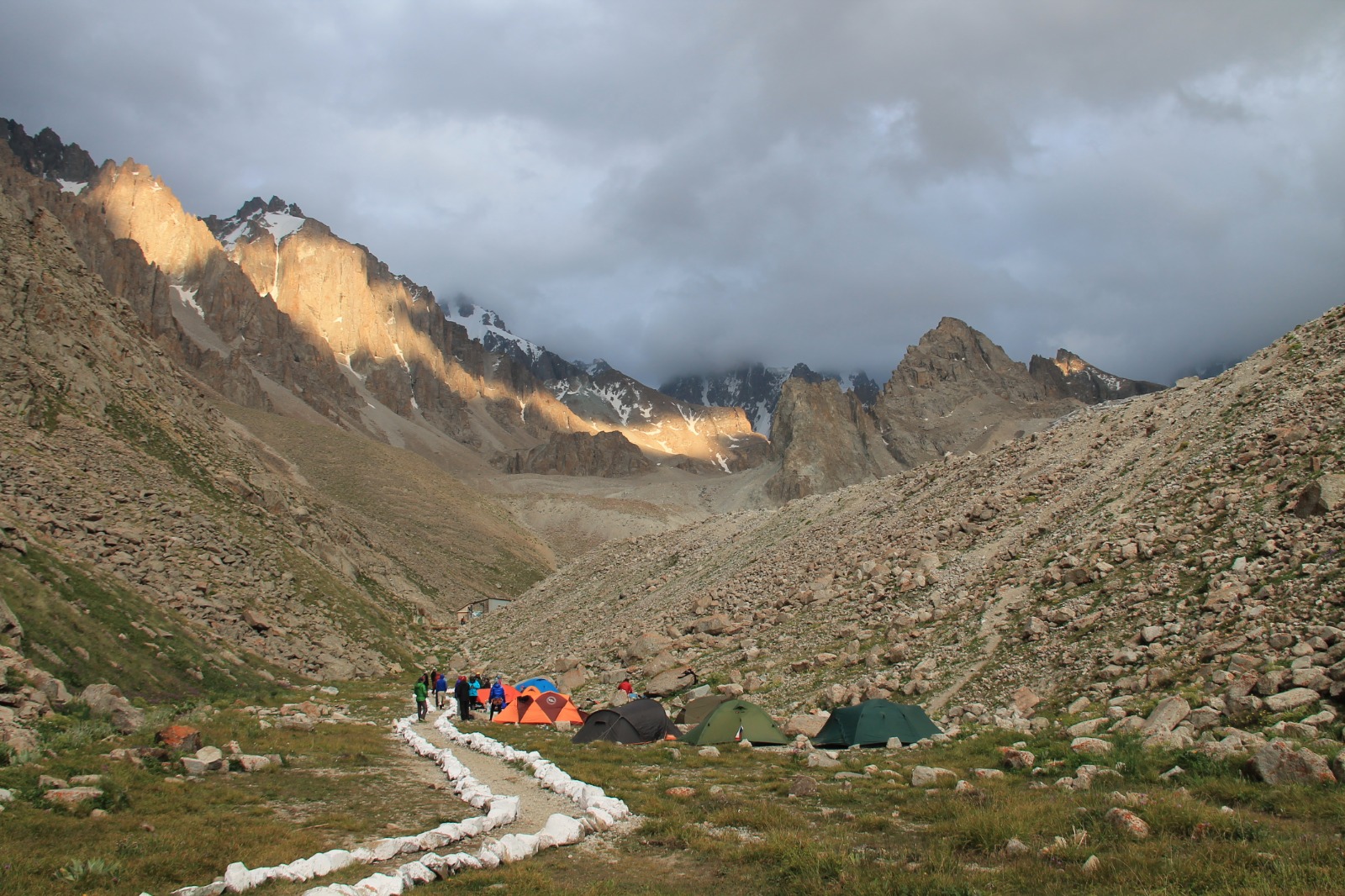
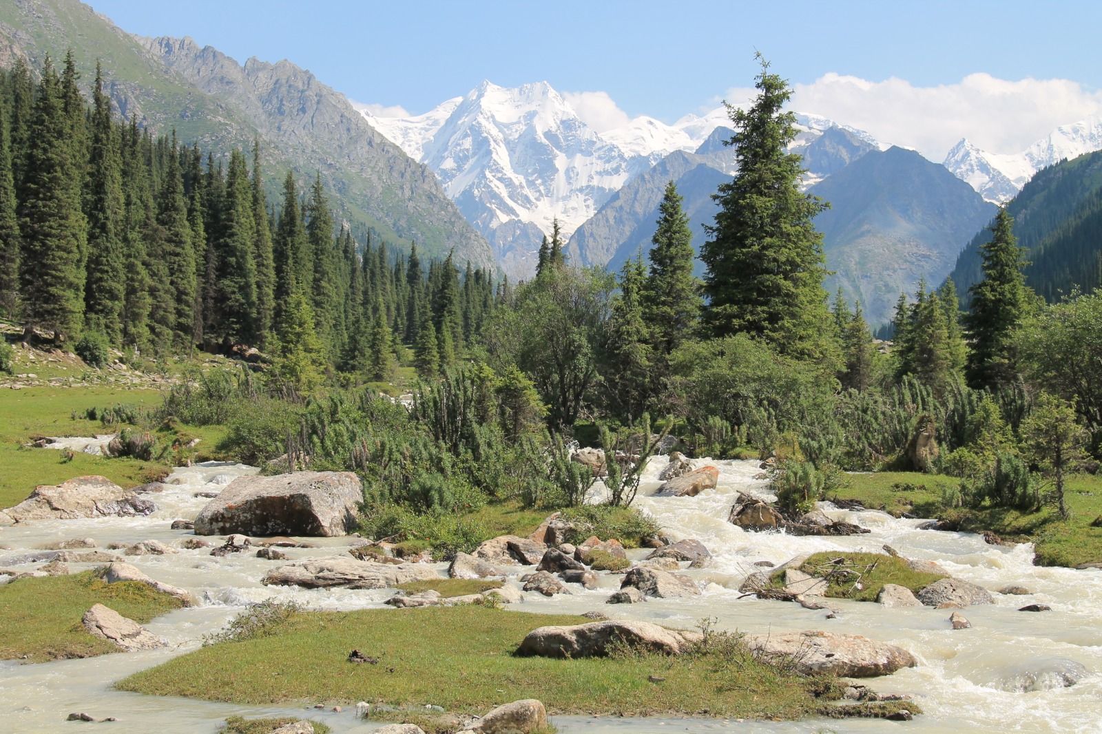
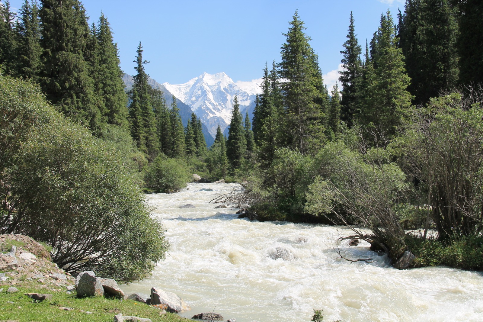
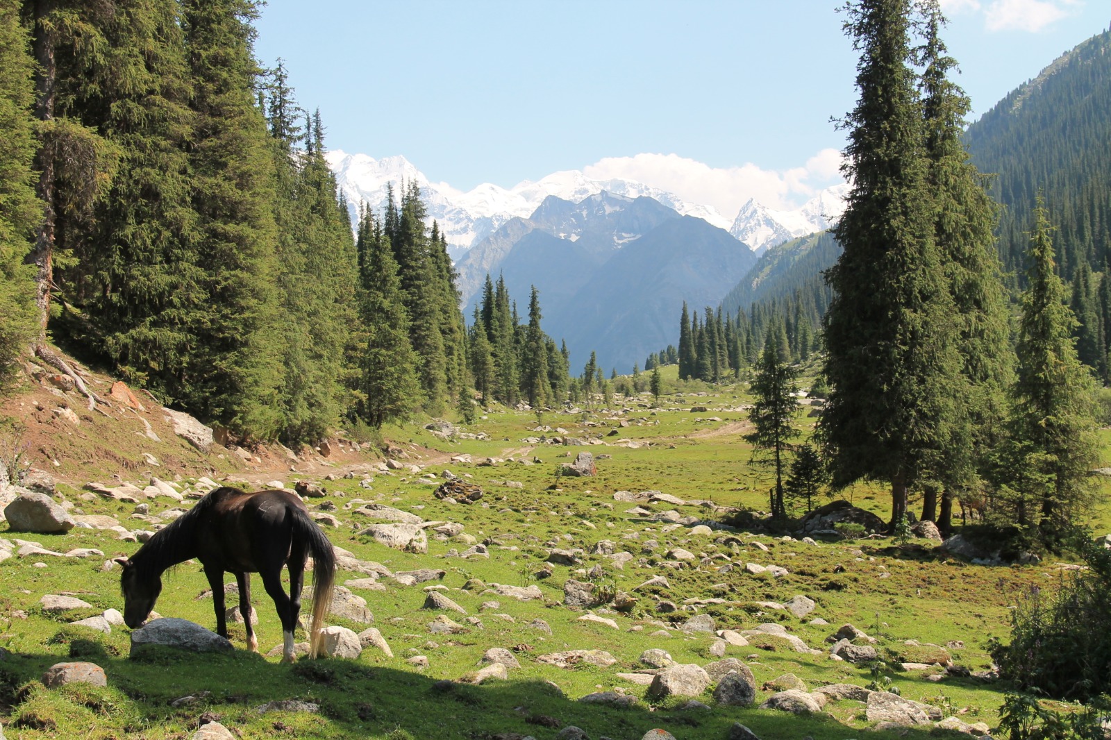
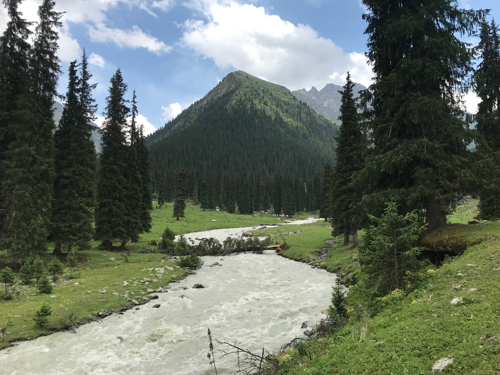
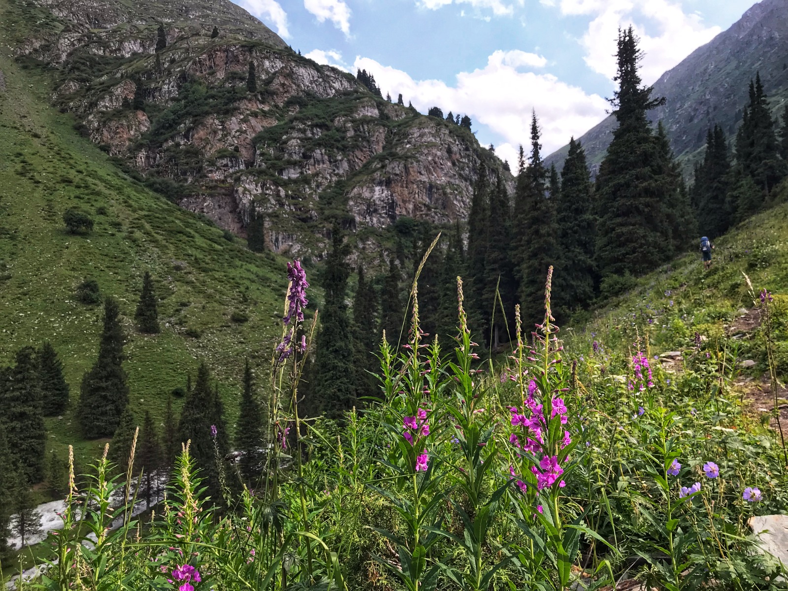
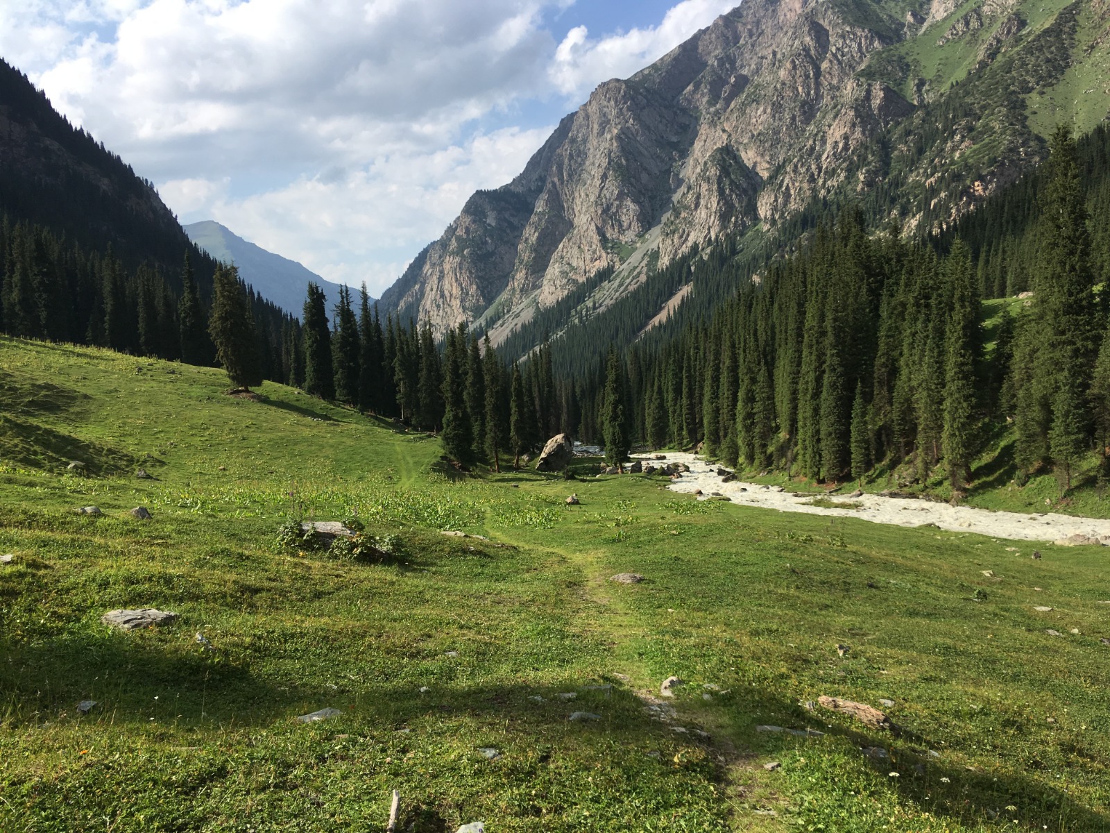
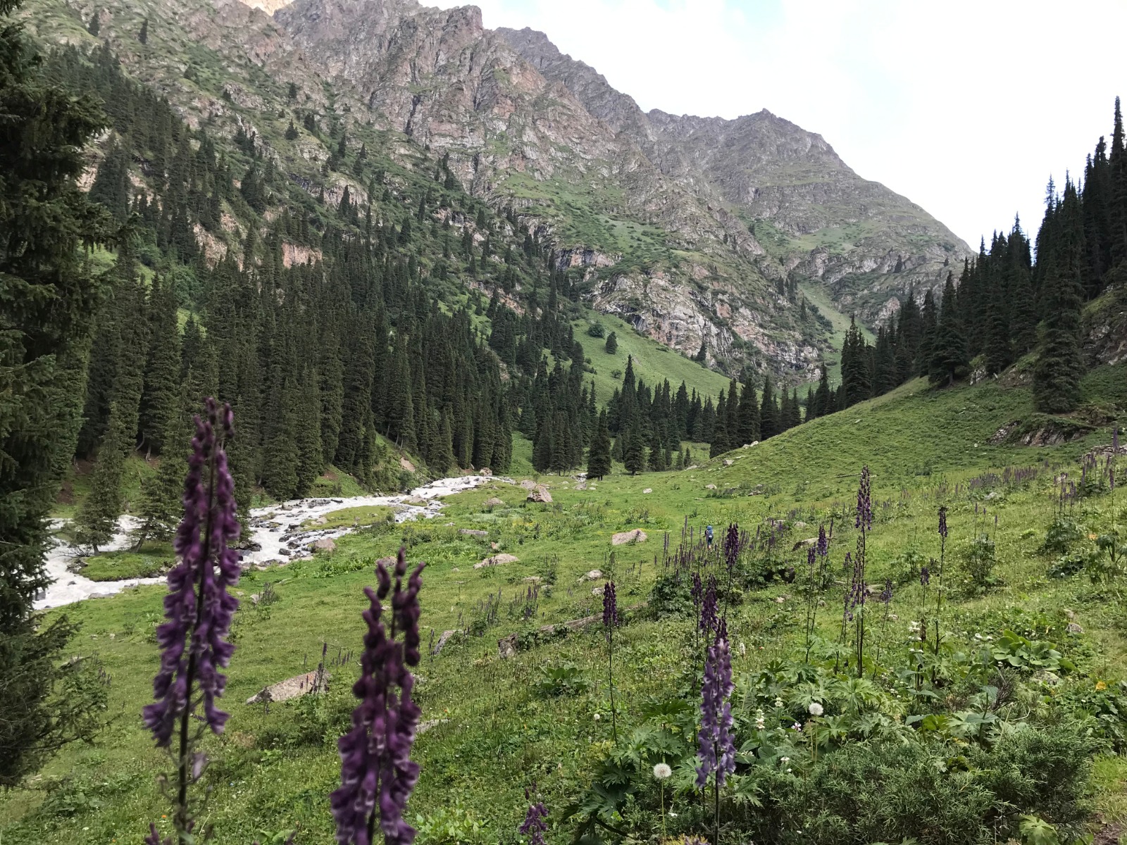
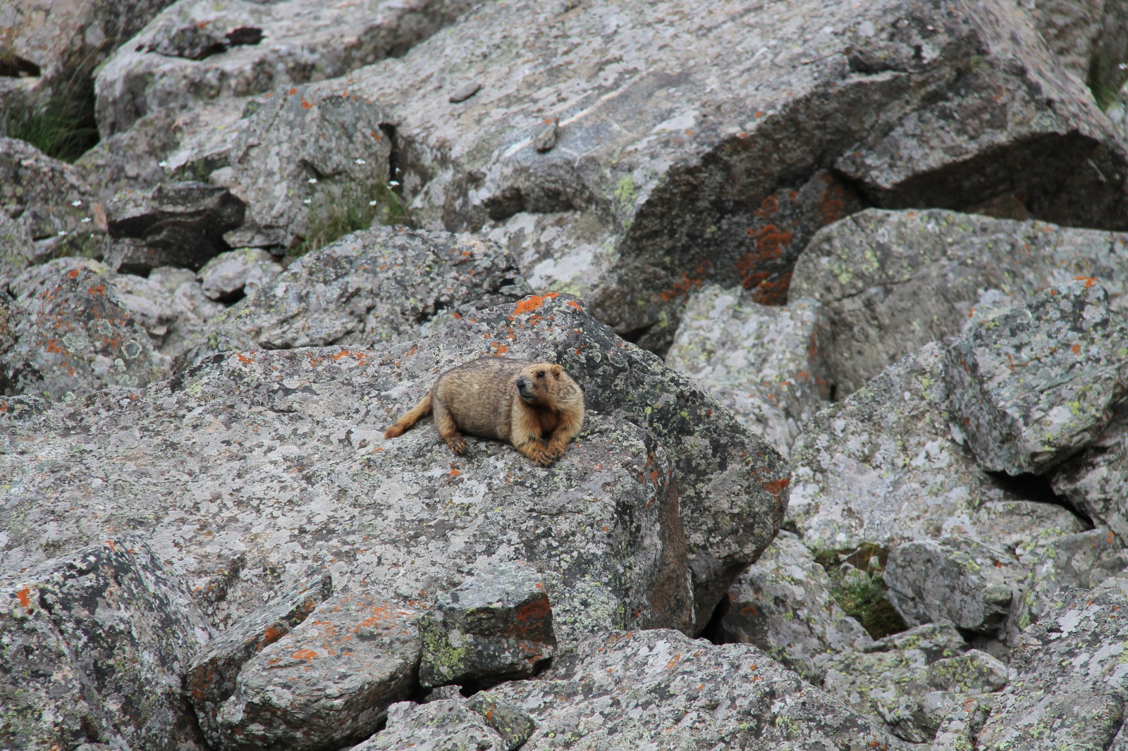
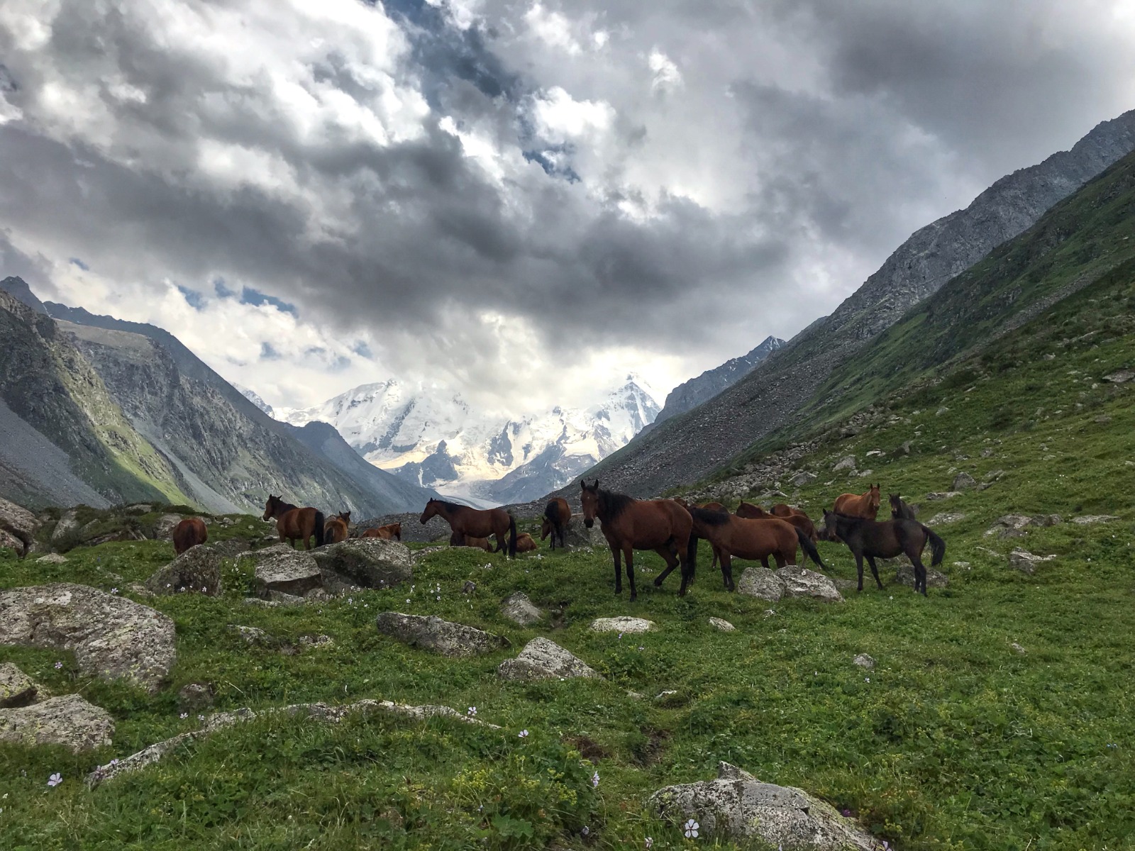
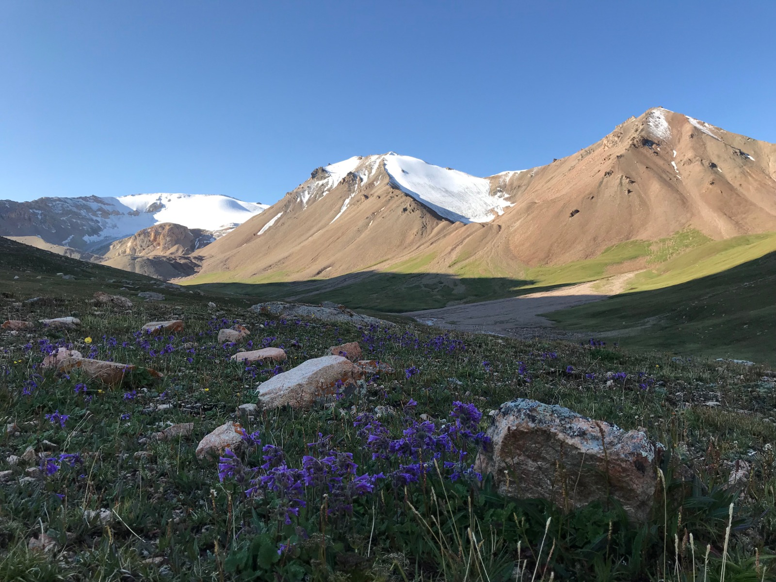
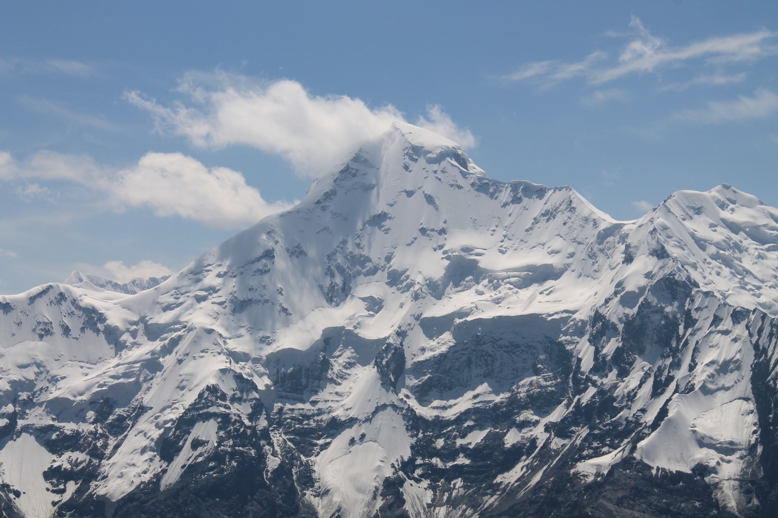
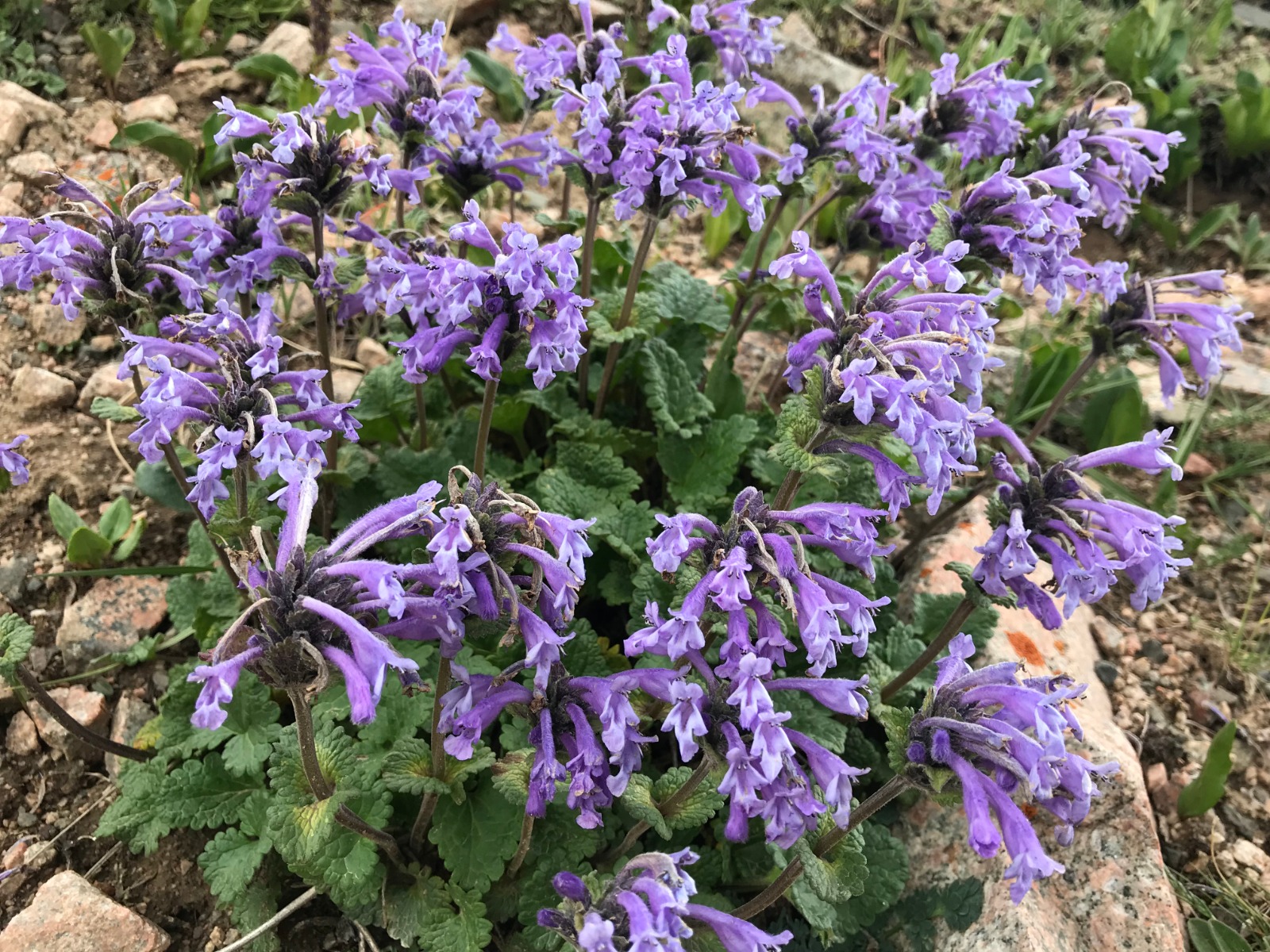
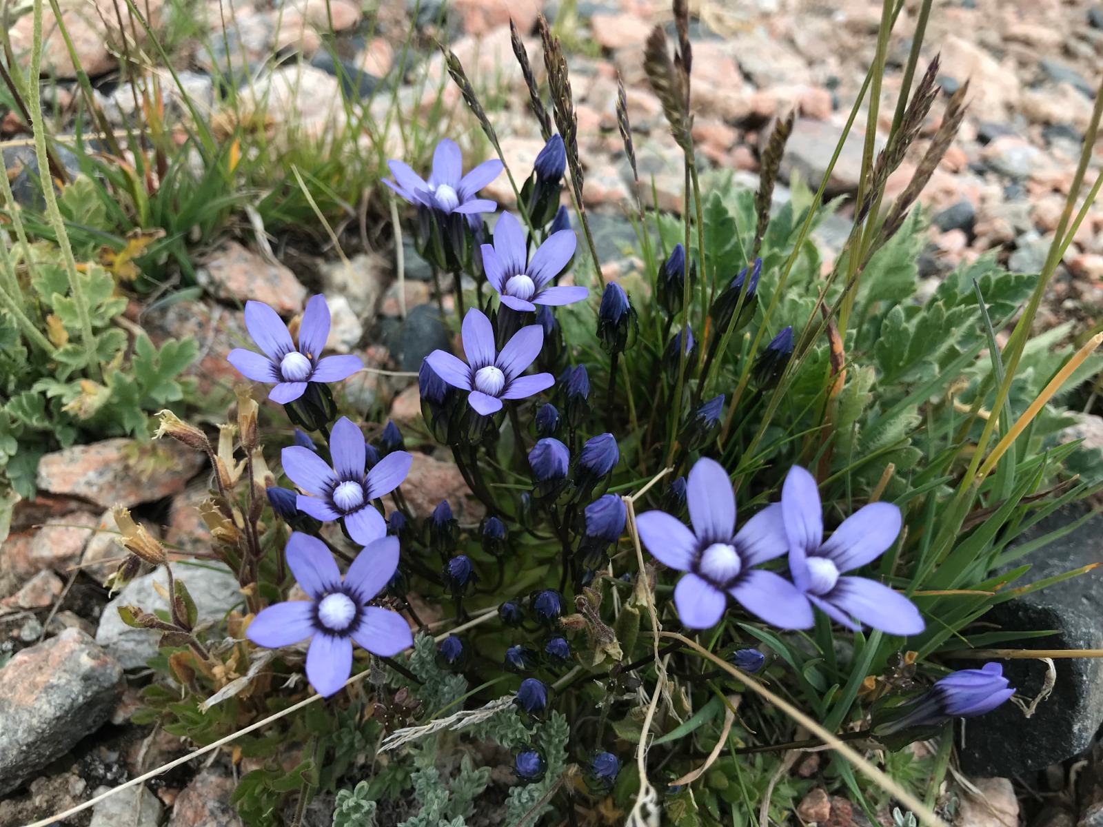
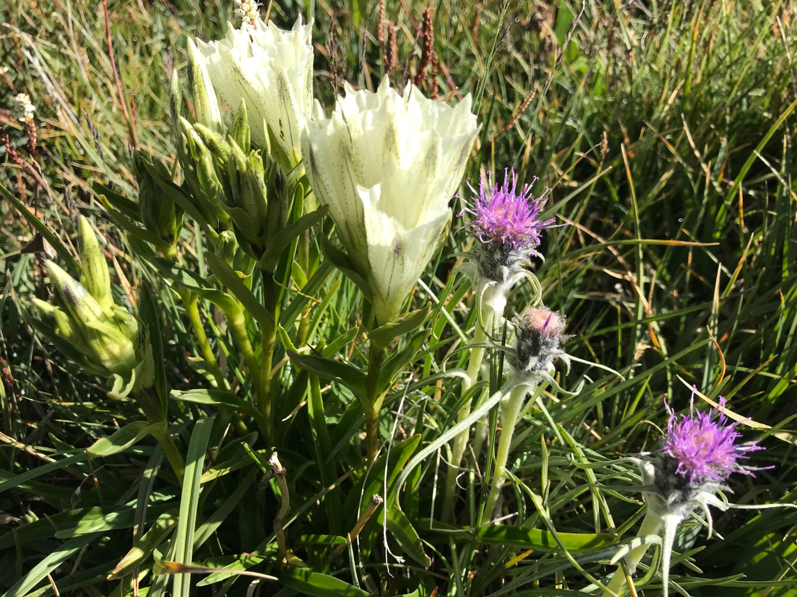
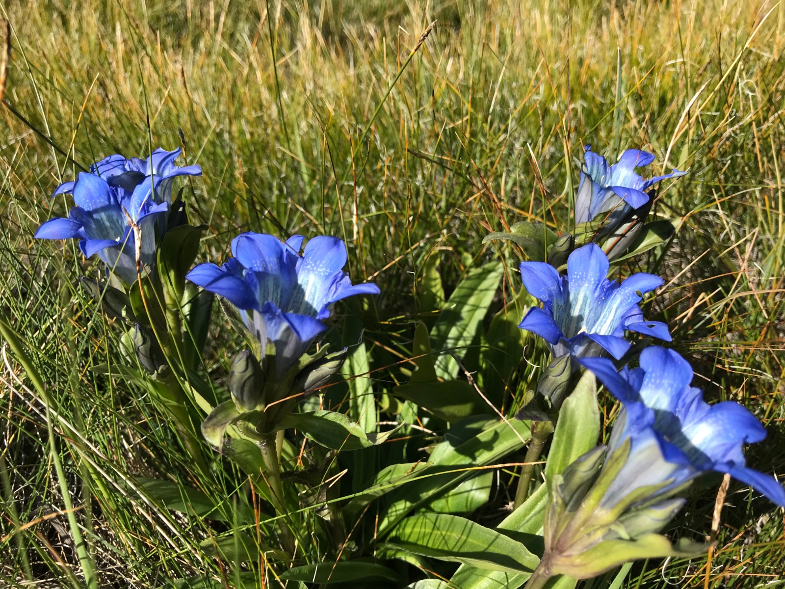
The trail from base camp towards Ontor Glacier led through fairy-tale forest and clearings on the right bank of the glacial river. We saw a lot of blooming flowers, marmots and grazing horses. Finally after 5 hours, 12.5 kilometres and 700 metres of ascending we found perfect place for camping close to glacial river with superb view of Karakol Peak (5 281 metres).
DAY 9 - Karakol Valley - trail to Ontor Glacier and back to the valley
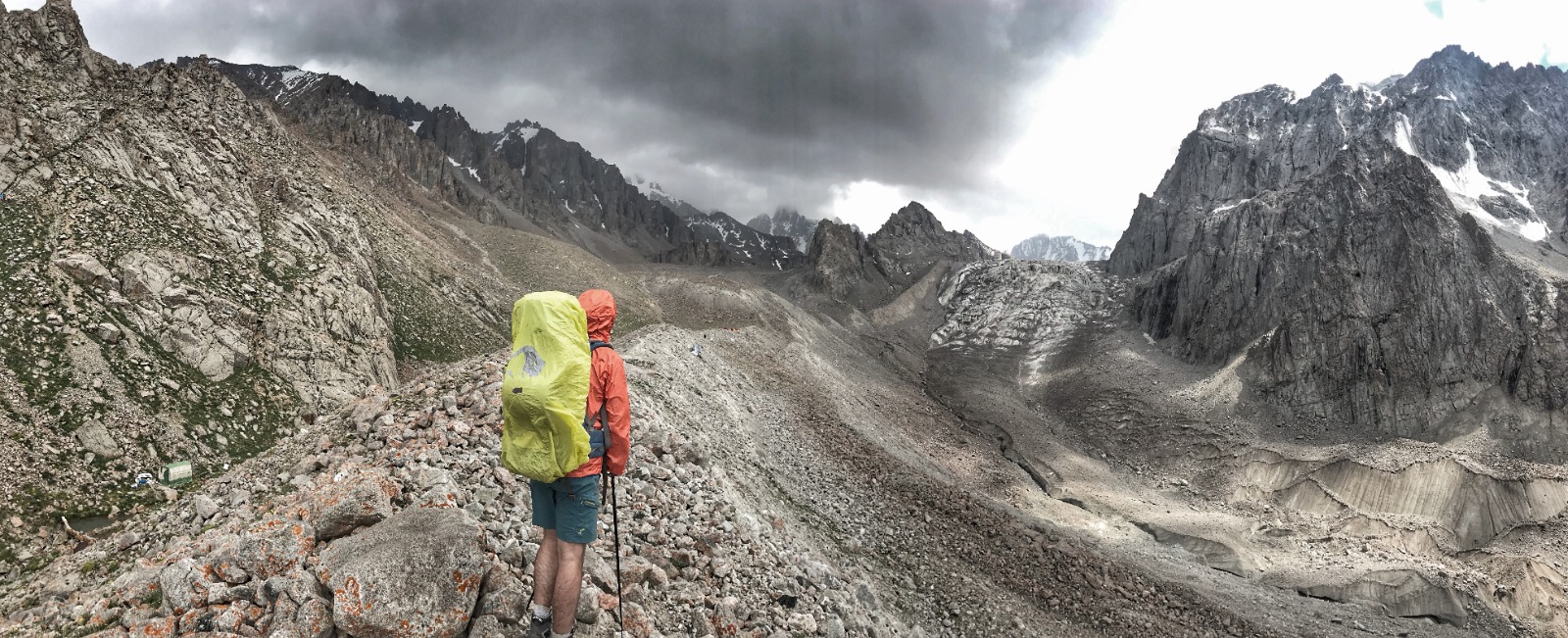
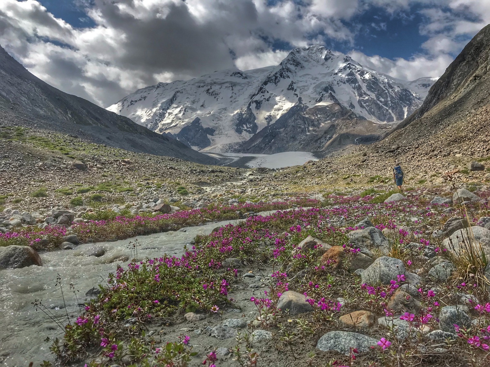
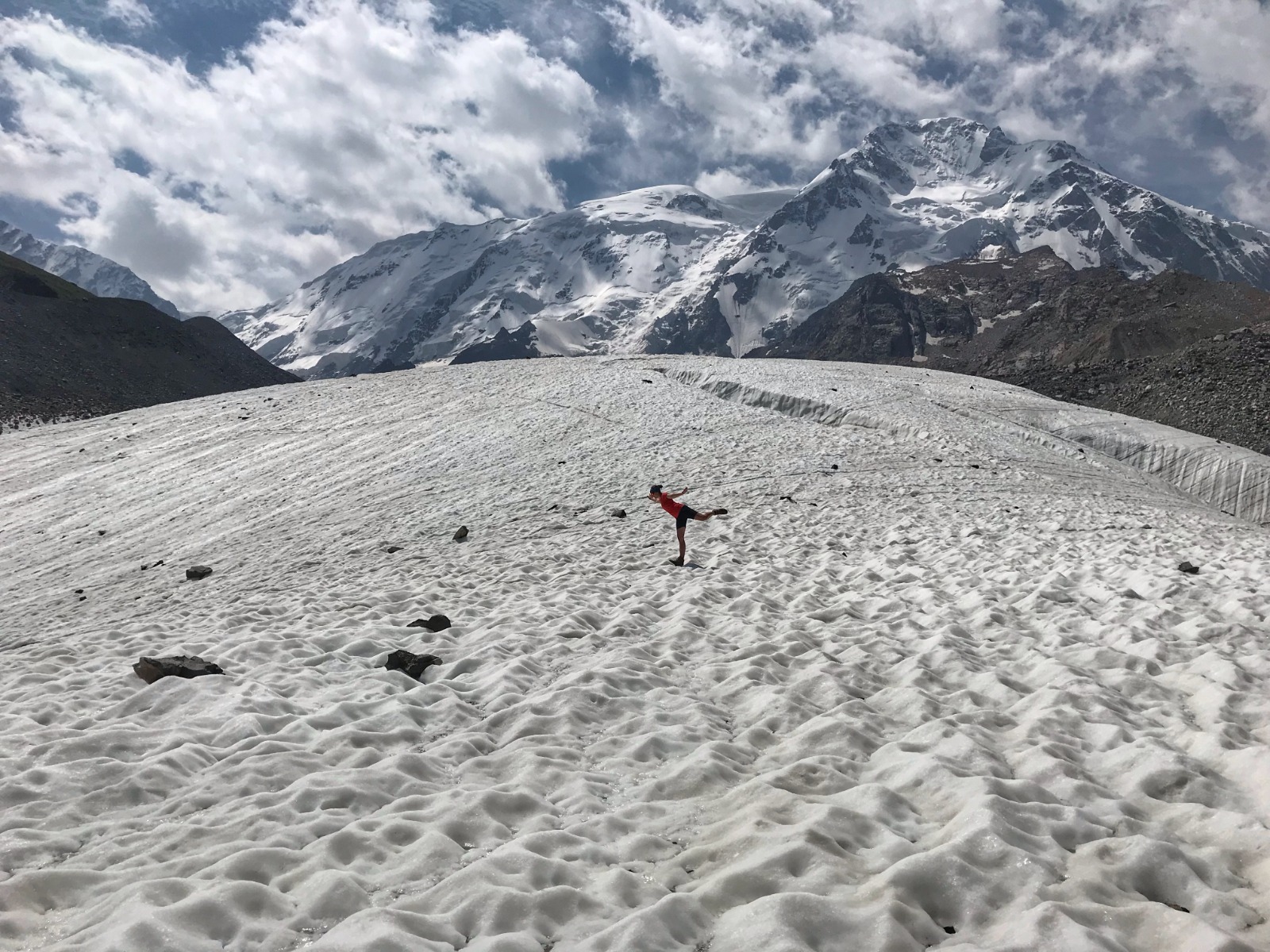
We set up alarm clock during the night to see the stars, but sky is full of clouds and it is raining, so we are not able to see anything. Our aim for today is reach the glacier and get back to our car in the valley. First 3 kilometres are smooth and we are photographing marmots along the way. Then it is about finding the right path between the rocks, streams and boggy places. However the views are superb.
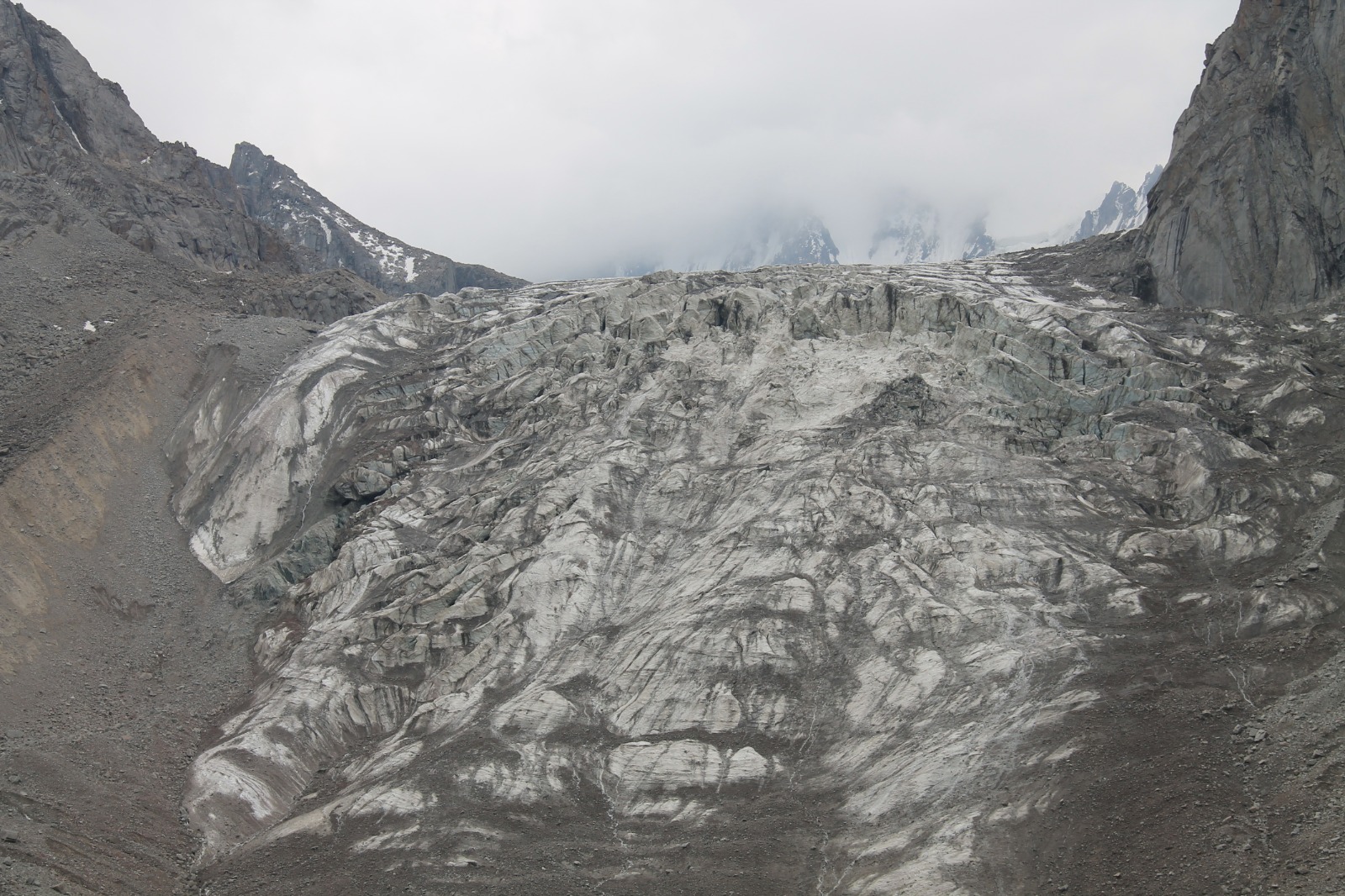
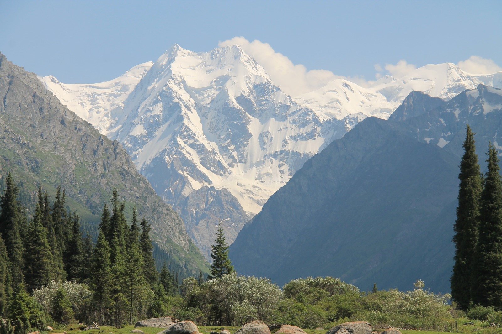
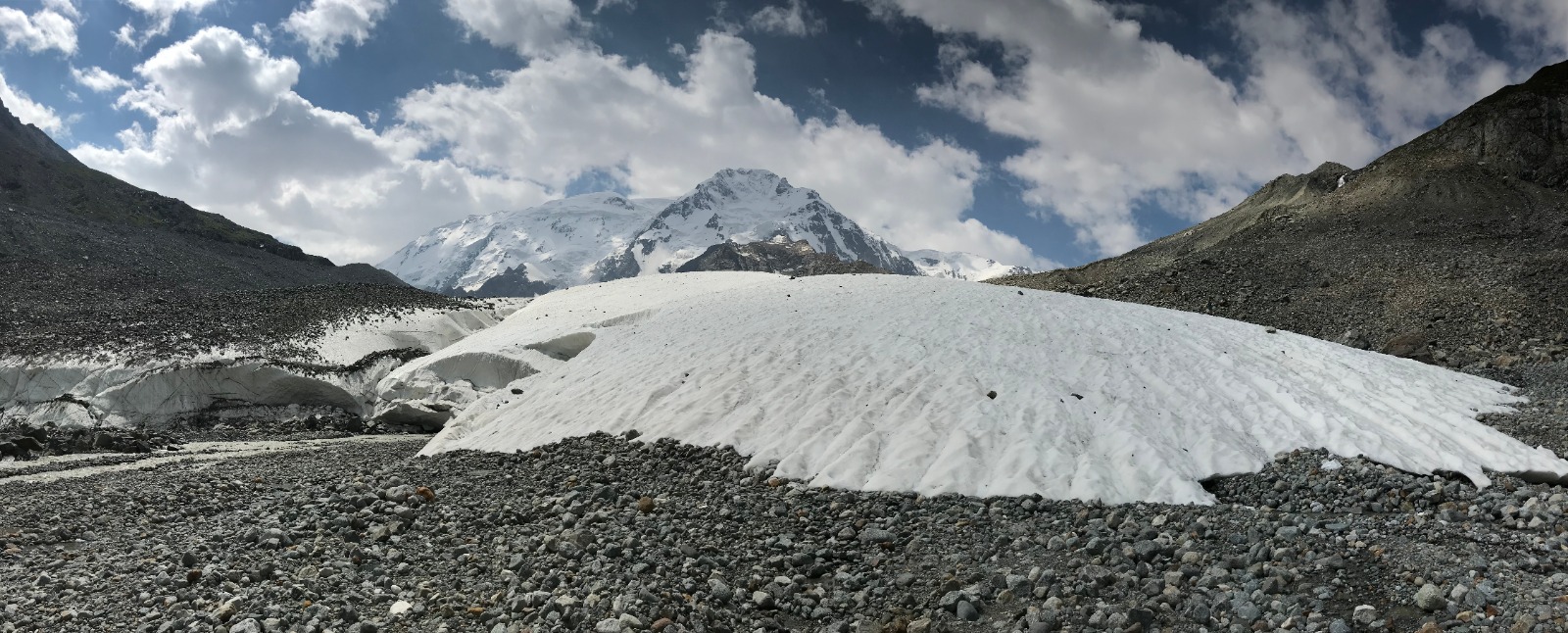
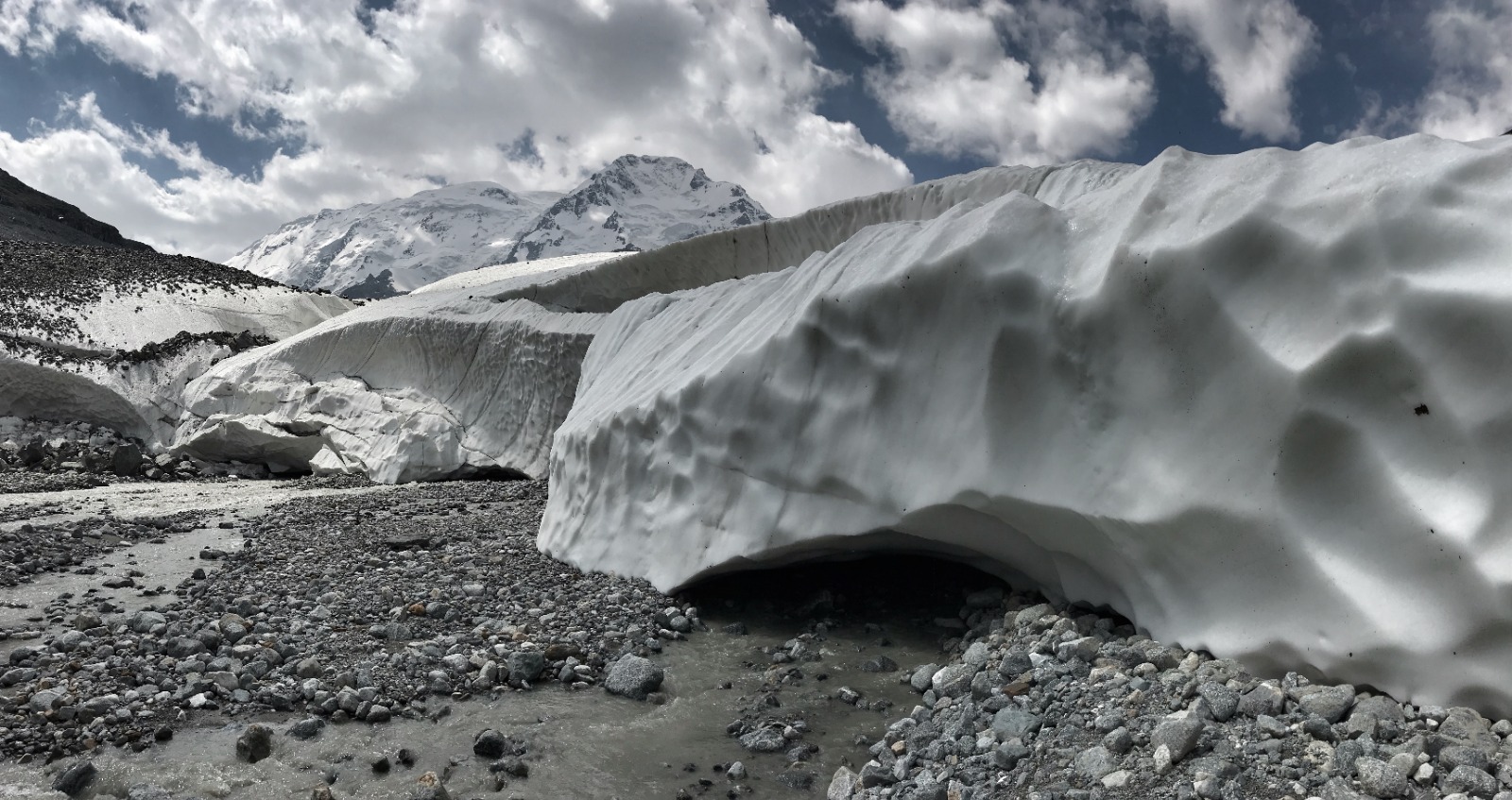
When we reached the glacier, clouds disapeared and sun was shining, so we were able to enjoy the scenery of Ontor Glacier and Karakol Peak at its fullest. The altitude is around 3 200 metres above sea level. We can also see another mountain higher than 5 000 metres called Djigit.
We spent around one hour at the glacier. After that it was time to say goodbye and head back to pick up our tent on the way. When we reached our tent, we already had 14 kilometres in our legs and it was still around 6 kilometres down to the base camp.
We were lucky to catch UAZ in the base camp that was willing to take us down to our car. We got off after bumpy road and our legs were so tired, that we almost had to crawl to our car. We set up a camp, cooked warm dinner and fell asleep immediately.
DAY 10 - Karakol Zoo, Jyrgalan village
After 2-days of wandering to glacier and Karakol Peak rest day is very much needed. We need to stay around Karakol city in case permit to Chinese border is executed. So we decided to spend a day in car and explore the area around Karakol city. But at first we visited local zoo in Karakol. It was not a good idea, because the conditions animals have to live in were terrible and it was very depressing.
We needed to light up our mood with good meal in ethno restaurant that was decorated as yurt. We tried Manti (dumplings filled with meat) and Lazuro (traditional meal made of meat, vegetables, rice and pepper sauce) for the first time. Both were delicious and we swallowed it very quickly being hungry after our trail in the mountains. After good meal it is time for good coffee in Lighthouse Karakol.
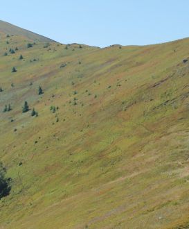
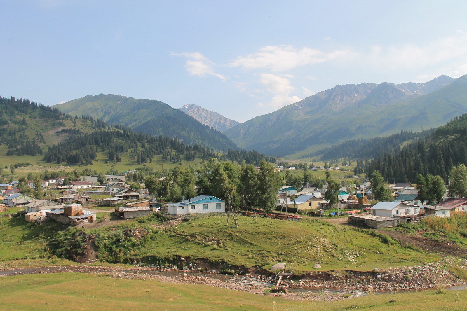
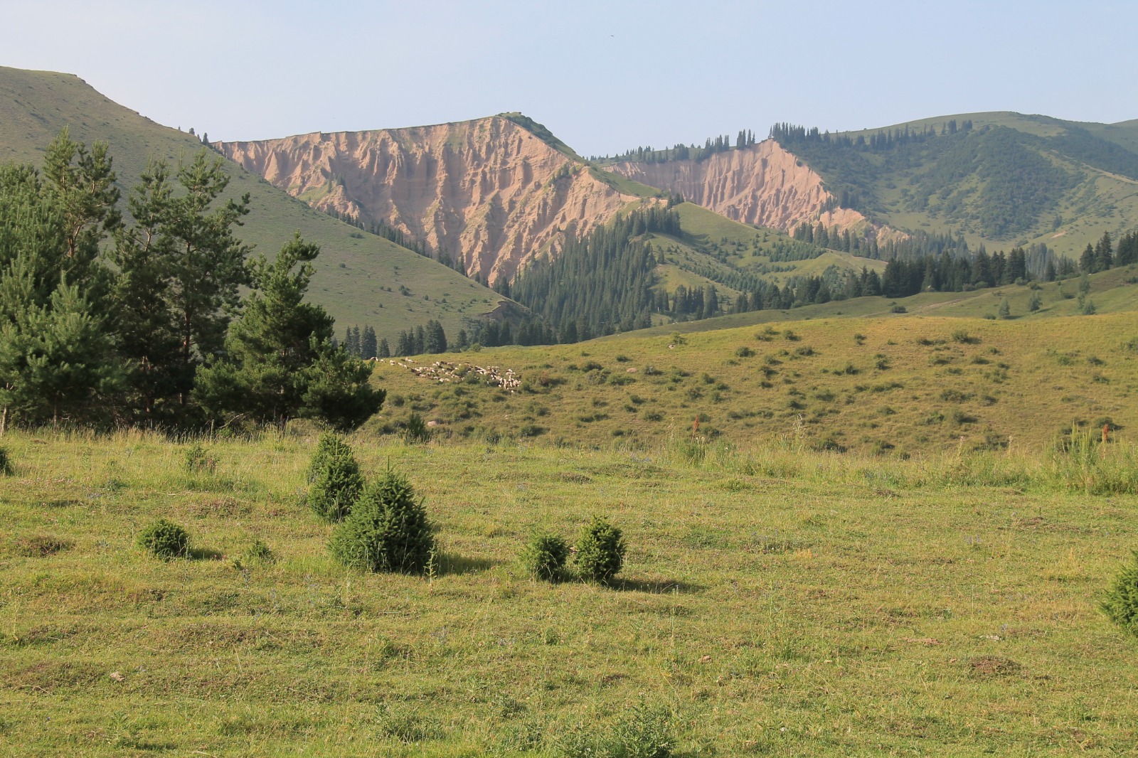
With our bodies fully satisfied we headed on the road towards Jyrgalan village and its valley. It is around one hour of ride and we have views of different sceneries than before. There are small fields around the road and a lot of greenery. We also encountered a huge flocks of crows. It was a little terrifying and one time we even had to stop our car to let huge flock pass. Jyrgalan village is surrounded by round green hills and the scenery is very peaceful.
We returned the same way to Karakol and enjoyed a night under the roof in hotel.
DAY 11 - Karakol, Chon-Ashu Pass, Echkilitash
The morning was full of expectations how the story with our permits will end up. After tasty breakfast we got a message from Ibraim, that he got the permit for us. We were so happy, because we almost lost hope. We were going to the centre of Karakol to buy some souvenirs and also chocolate for Ibraim for his service. When we met him, he was all sweaty, because his bike broke on the way and he wanted to give us the permit as soon as possible.
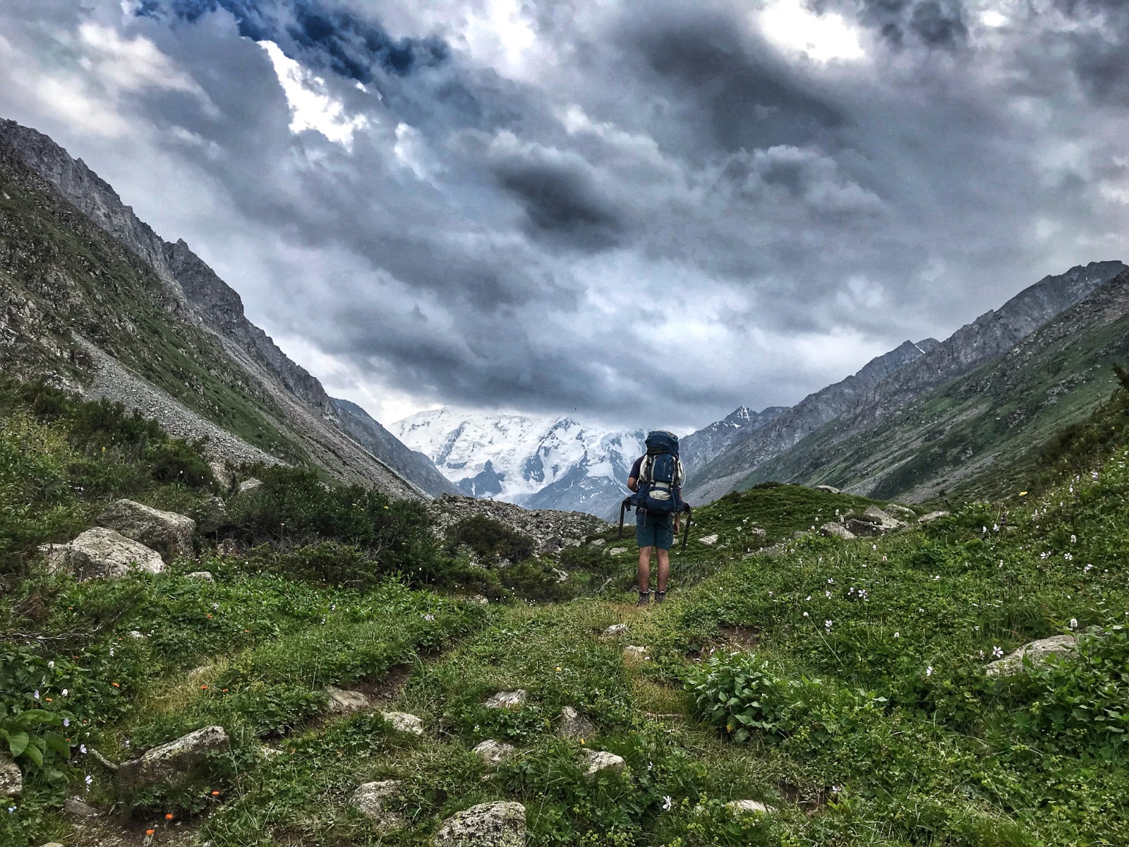
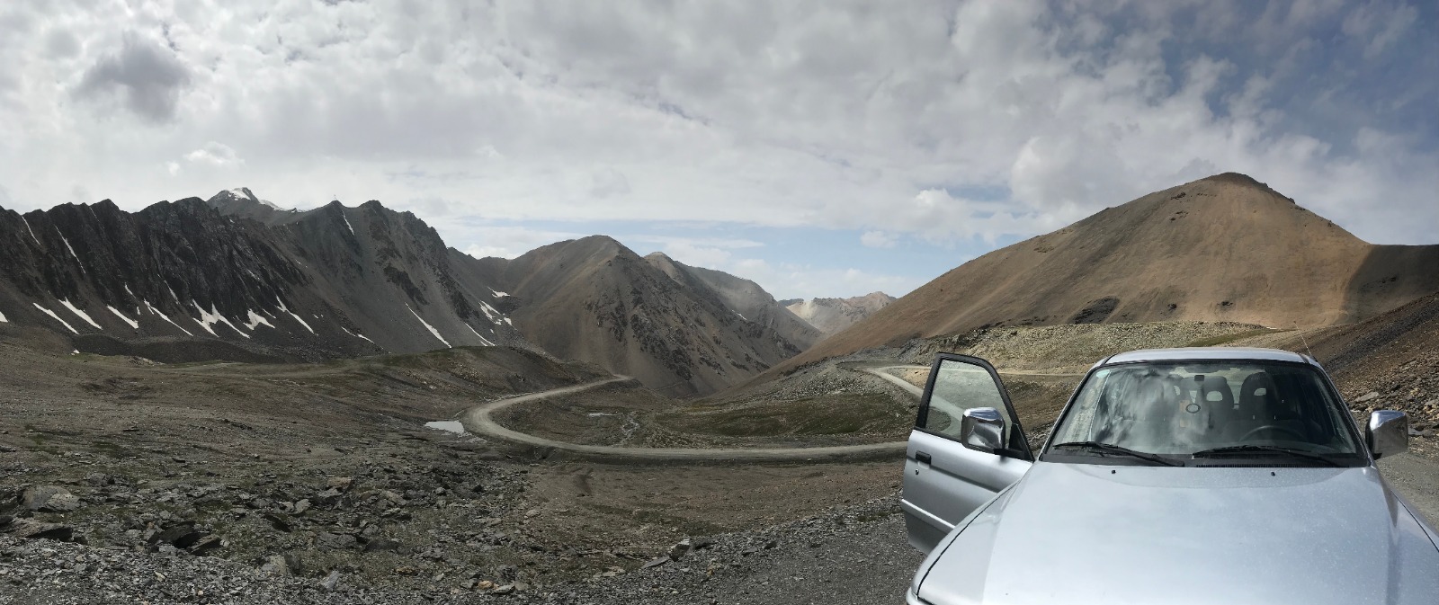
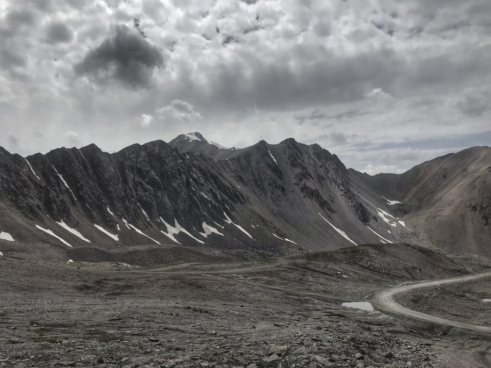
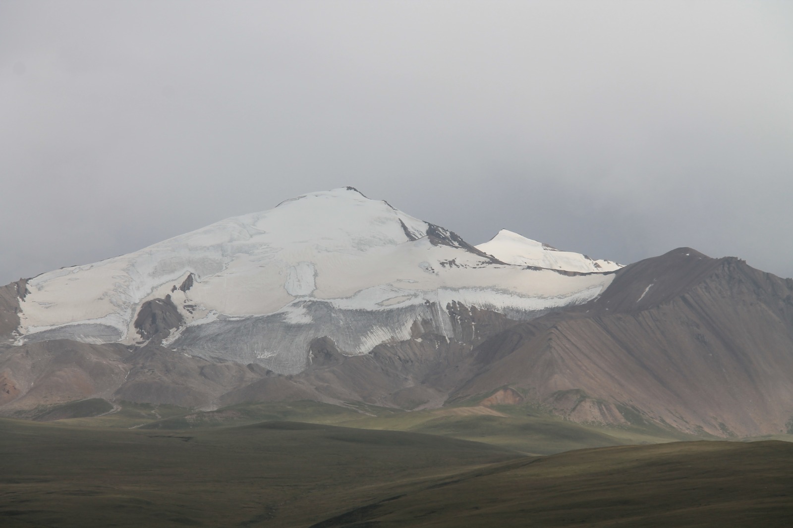
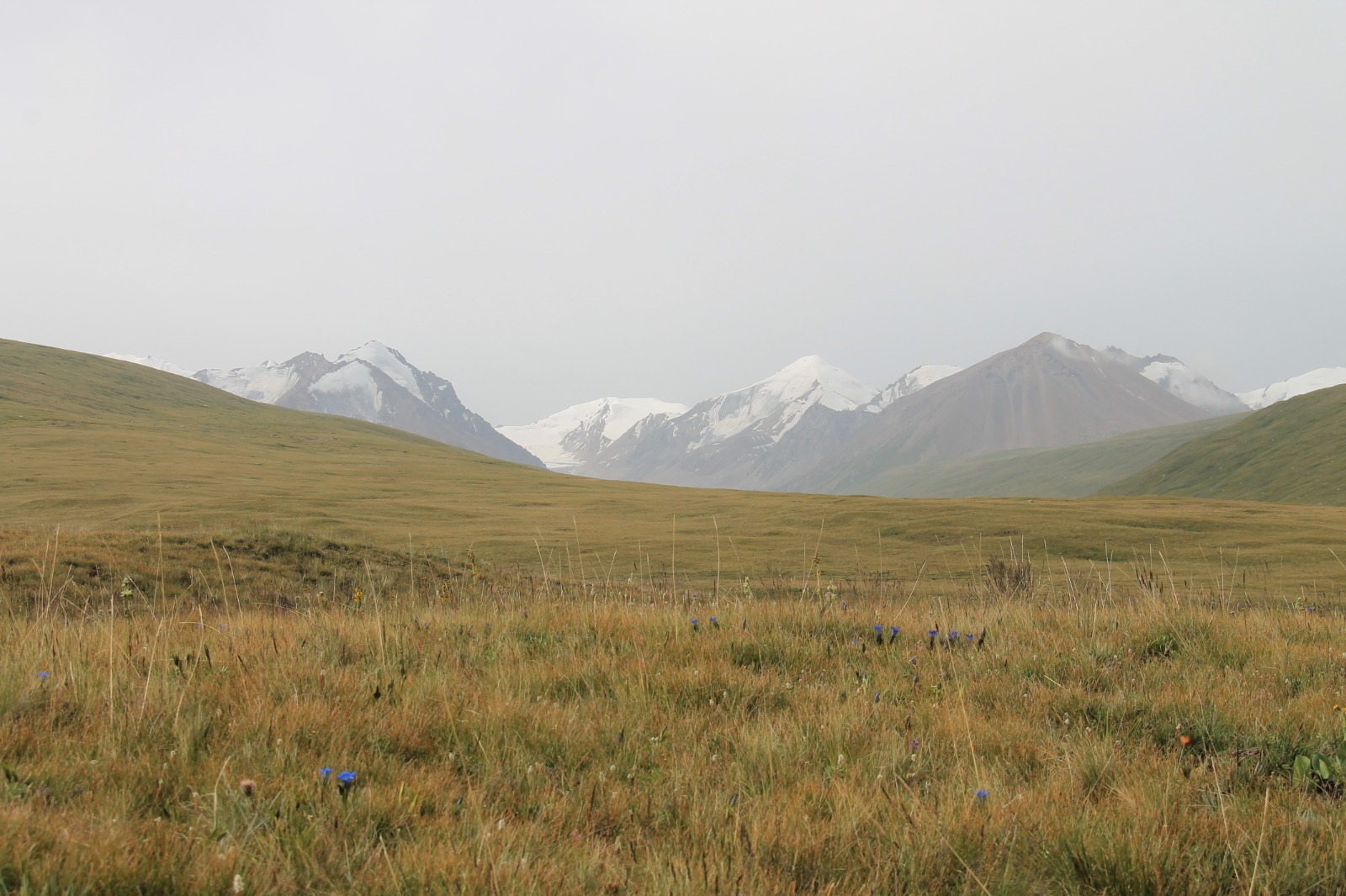
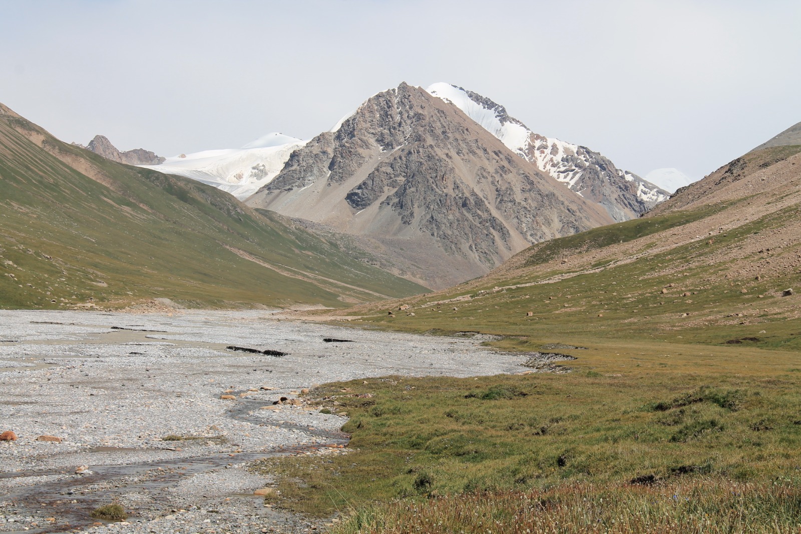
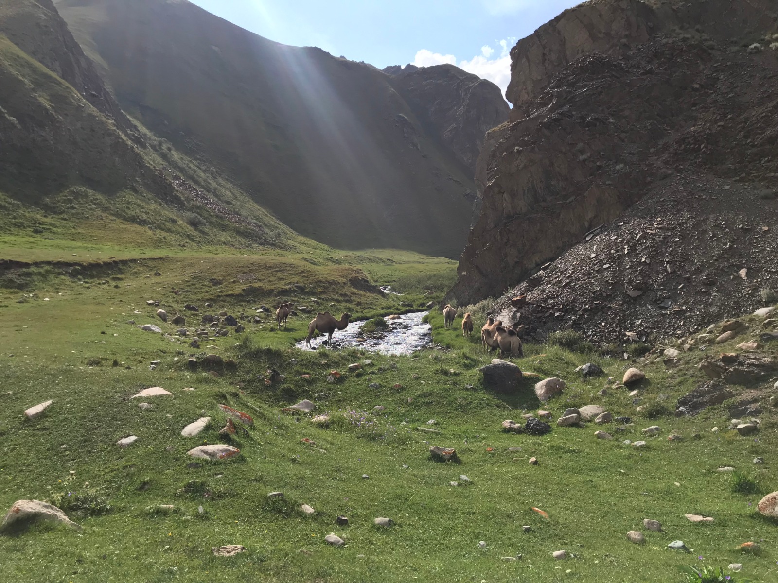
With permit in our hands we quickly jumped into our car, refuelled it at gas station and headed on the road. It took around 5 hours (140 kilometres) to get to Echkilitash, which served as starting point of our trail to Tyuz Pass and Pik Vit. We went through beautiful wide valleys with sheep, goats, cows and only few local people. First challenge was to overcome Chon-Ashu Pass (3 822 metres). There were no terrifying sections as we expected, so our car handled it with no problems. First military checkpoint was at the crossroad, where we had to abandon the main road. We didn't have any problems with the soldier. We just showed him our trail on the map and he let us pass.
The road to Echkilitash was little worse than the main road, there were also some small fords. Huge wall of white mountains was showing itself gradually. Our stop for this day was next to military base called Echkilitash. We wanted to walk a little bit today and cut some kilometres from tomorrow, but the sky was getting black and we even heard a thunder, so we just set up a camp and left it for next day.
DAY 12 - trail to Tyuz Pass and Pik Vit (first part)
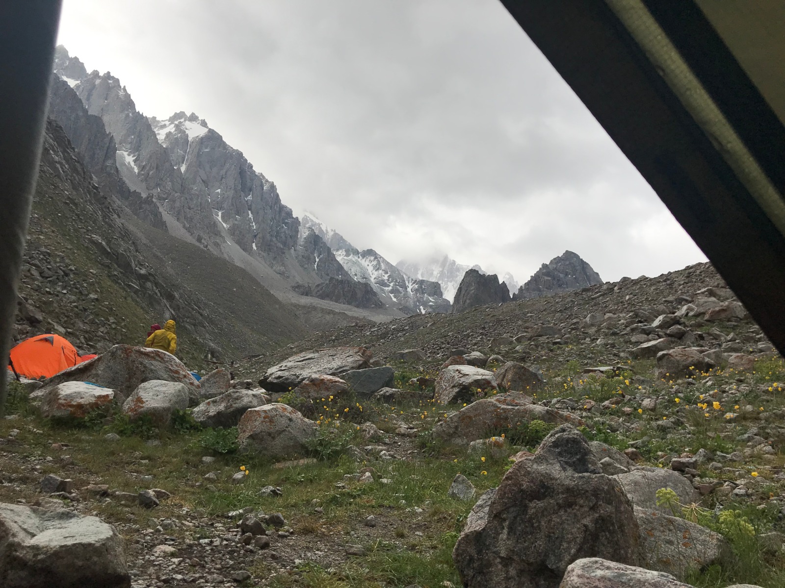
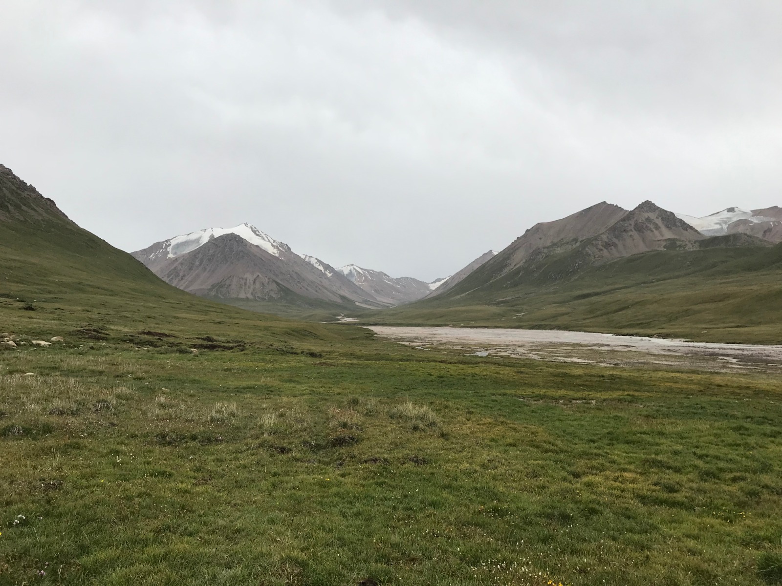
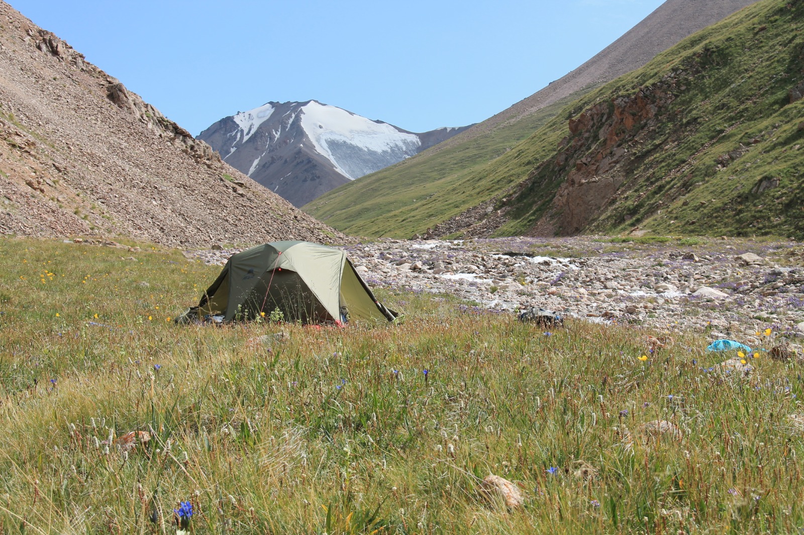
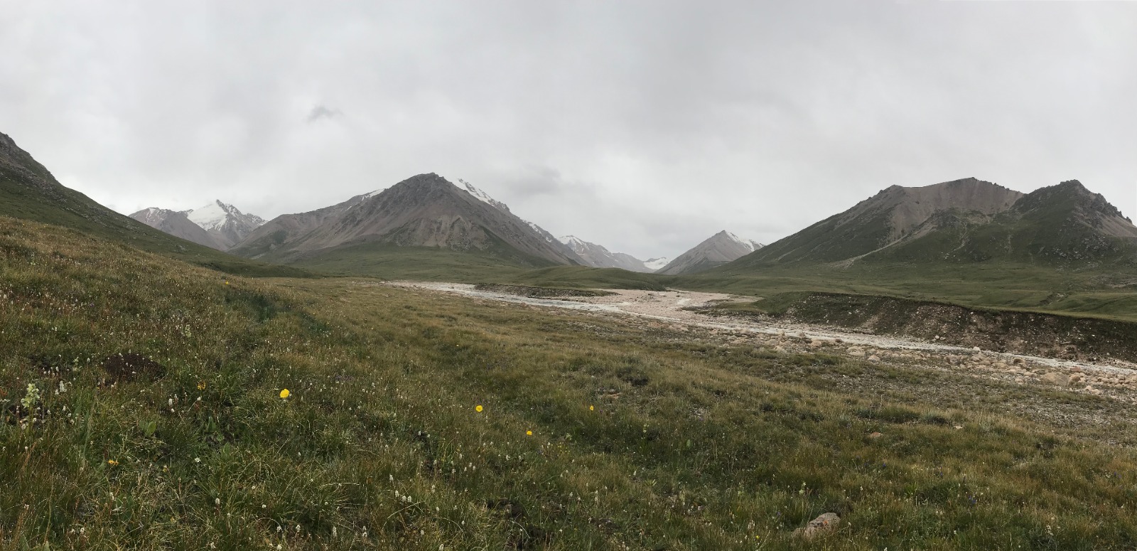
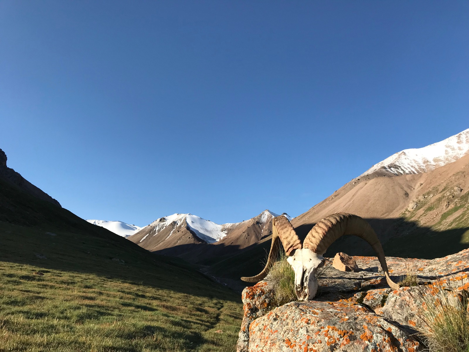
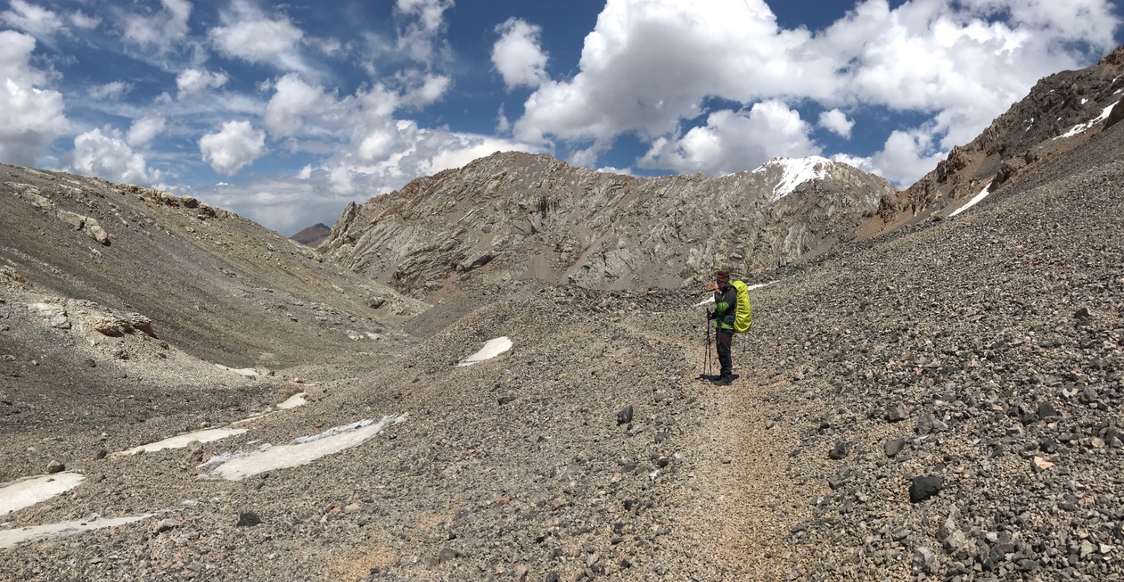
The morning was pretty hard, we were around 3 000 metres, it was raining all night and our tent was wet. It was not easy to pack up wet tent and all our stuff early in the morning when temperature was around zero degrees. Our path led us through grass meadows on the left side of Tyuz River. We were proceeding quite quickly and we had around 10 kilometres in our legs around 10 o'clock. We met local cowboy on the horse with his dogs keeping eyes on his herd. Our pace was getting slower because the path was getting steeper. Despite that we accomplished our 23 kilometres long day around 2 o'clock.
The last obstacle was the river we had to cross. At first we picked up a wrong and dangerous ford, so the water was reaching our waist and current was really strong. But the second attempt was better and we found ford that was definitely safer. We were lucky that sun was shining and we had all afternoon for drying and getting warm in our tent. It didn't last long until rain drops started to fall on our tent. So we stayed inside of our tent and were relaxing before final climb.
DAY 13 - trail to Tyuz Pass and Pik Vit (second part)
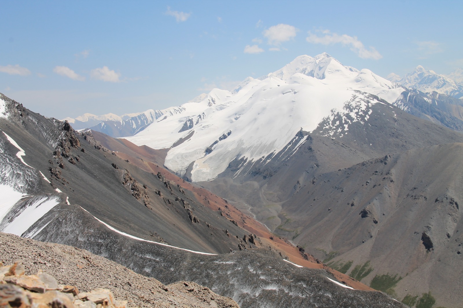
The morning was very cold. It looked like it was freezing during the night. We decided to make our climb to Pik Vit (4 215 metres) only with necessary items and left rest of our stuff in our tent, because we will be going the same way back and will spend the night after the climb at the same spot. It was supposed to be around 5 kilometres and 600 metres of ascent to Tyuz Pass (4 001 metres).
First half was quite easy and perfect to stretch our muscles. Only couple of boggy places we had to avoid were a little annoying. Then we reached a waterfall and saw our path going up next to it. When we climbed that part, we found ourselves in spacy valley surrounded by pointy summits. We spotted small tent on the other side of the valley and people waving at us. We waved back and continued towards the steepest part. We were trying to ascend slowly and steady to avoid the risk of altitude sickness. Unpredictable weather and altitude sickness were both things we were most worried of during our attempt to reach Pik Vit. But we were lucky that none of them hit us. Weather was amazing, it was sunny with almost no clouds.
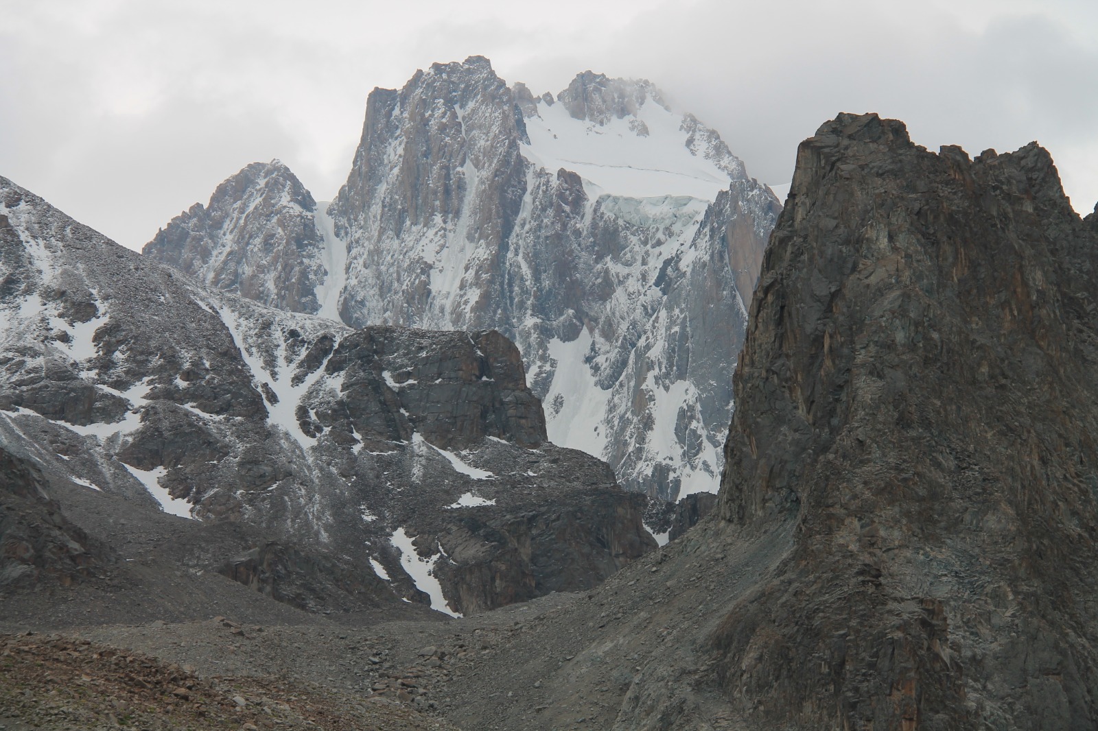
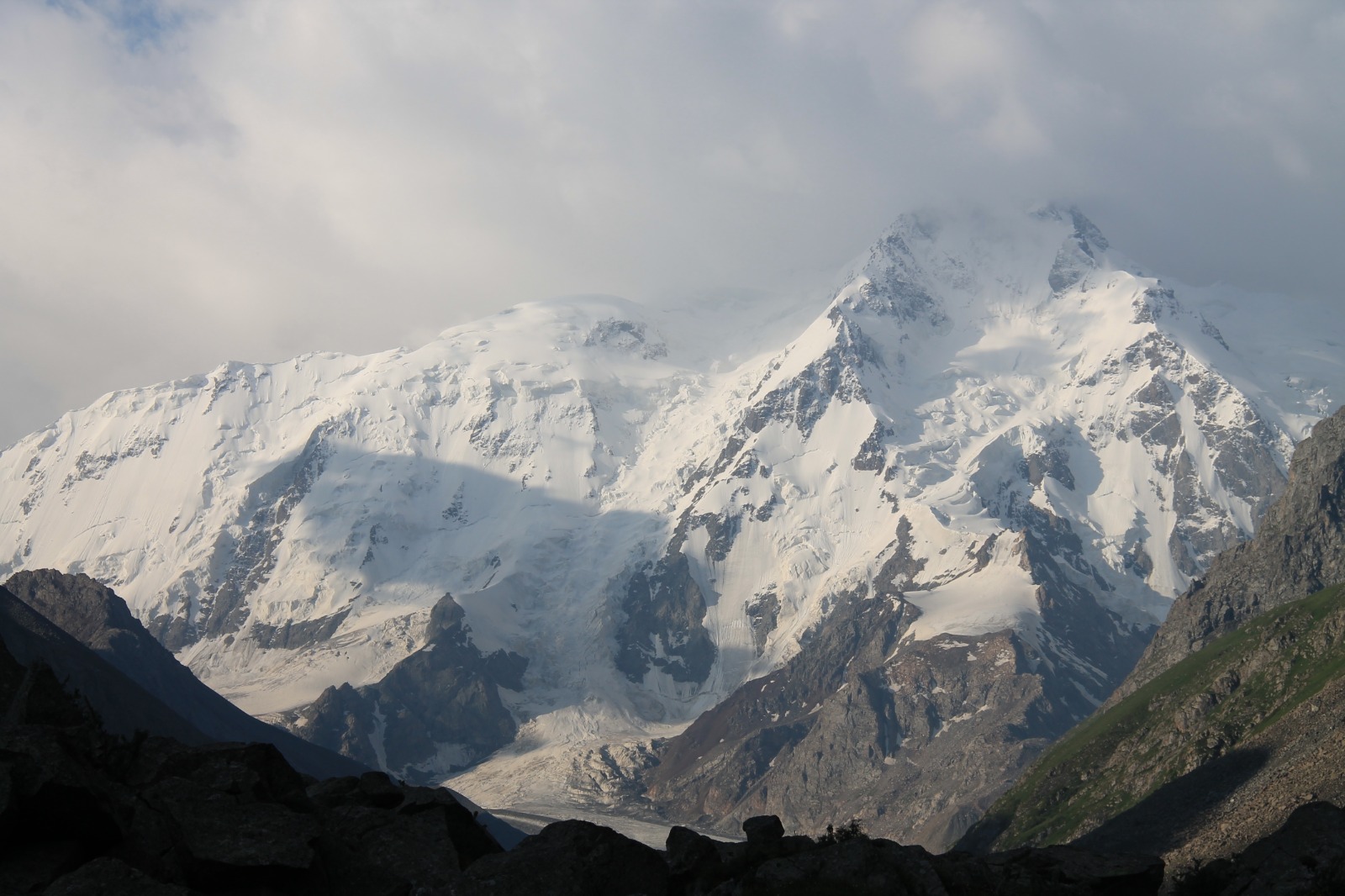
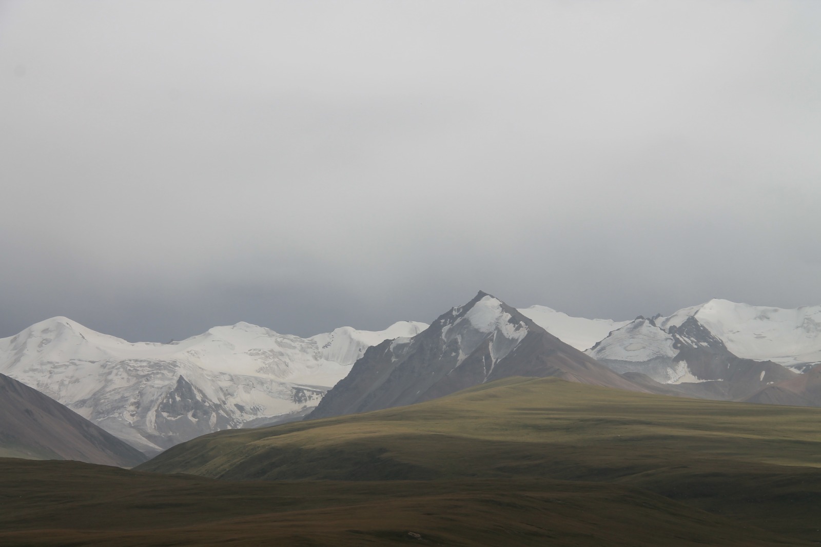
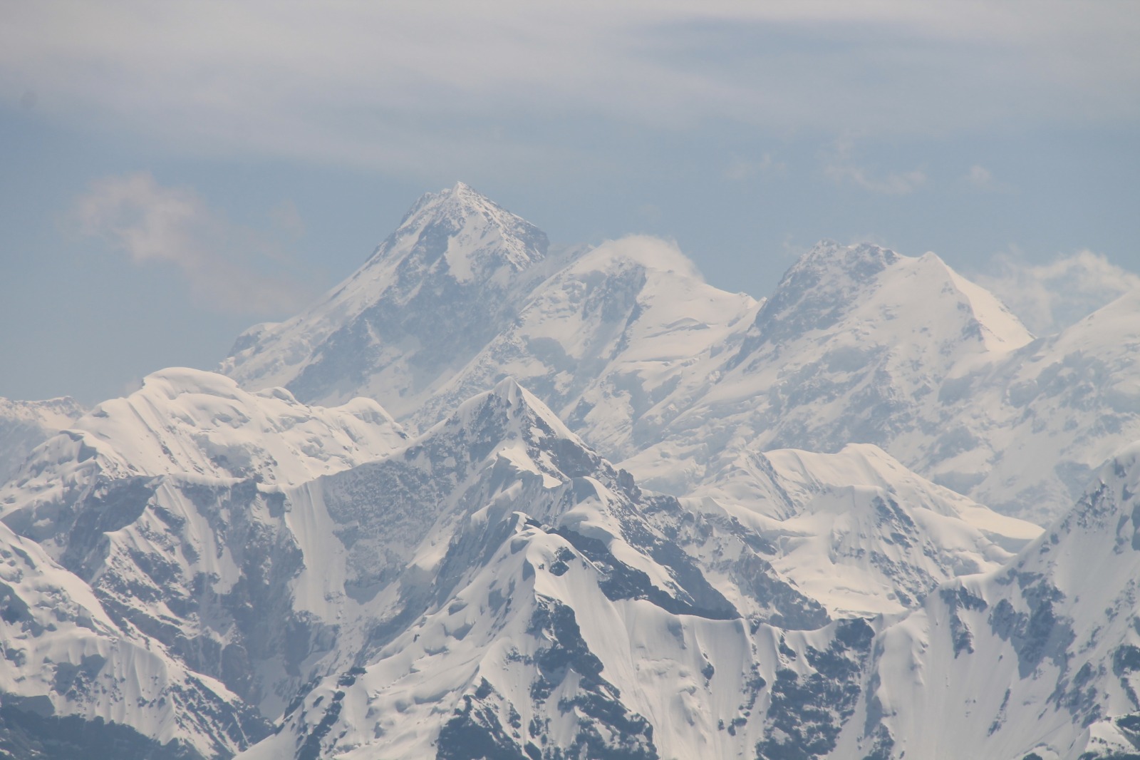
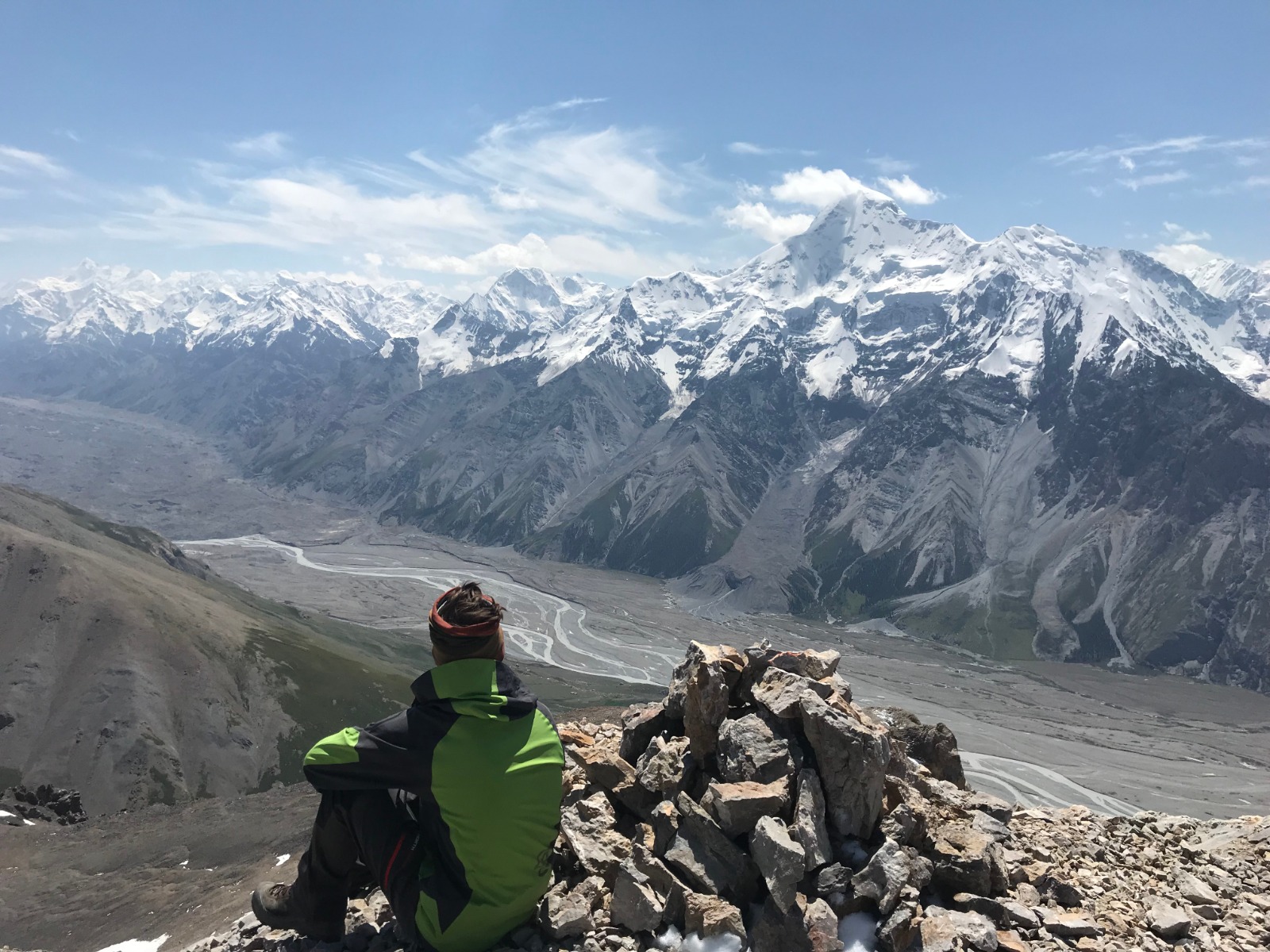
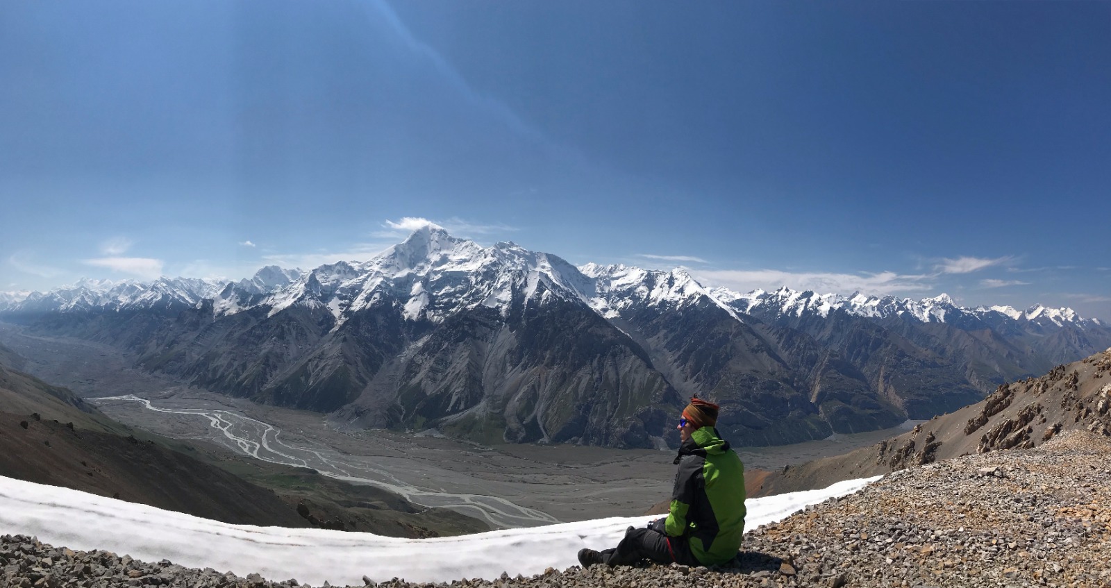
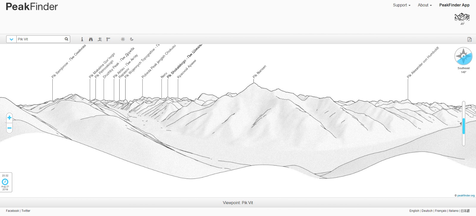
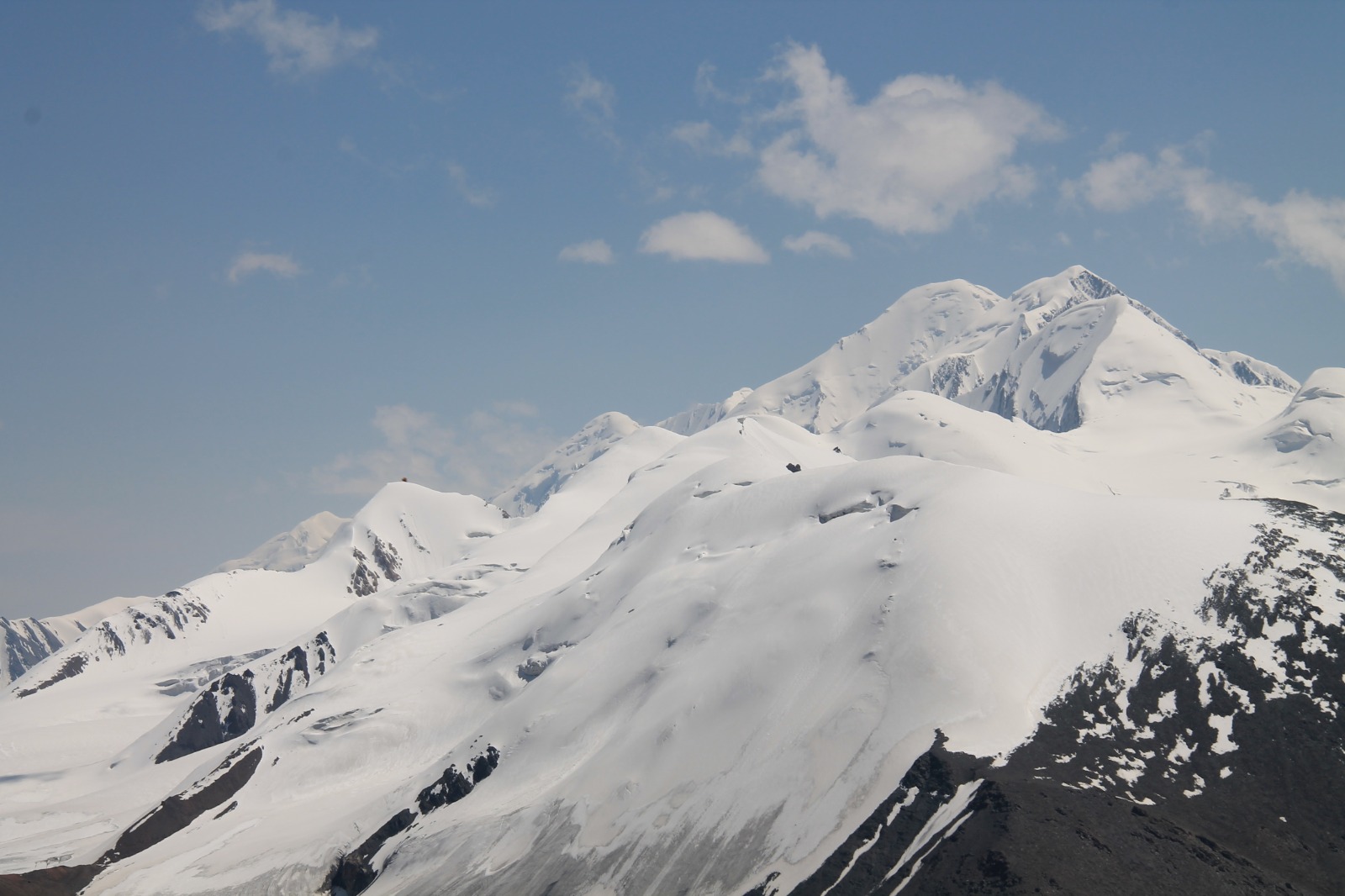
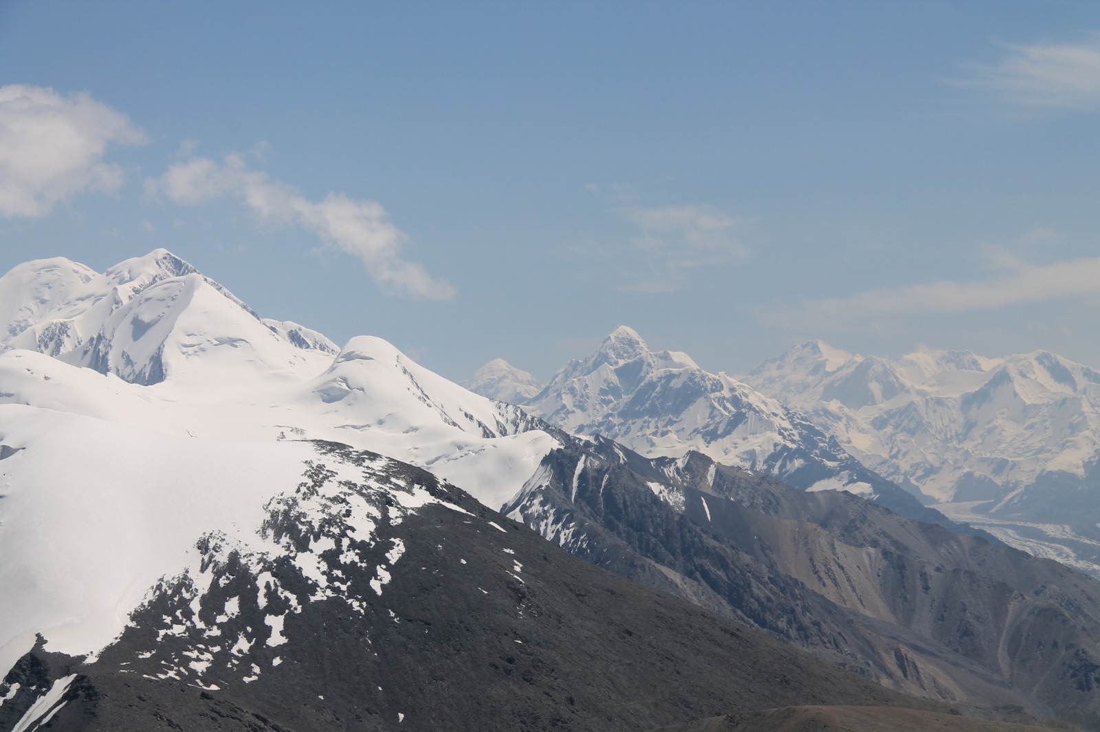
We reached Tyuz Pass (4 001 metres) with no problems. What we saw took our breath away. The view of Enilchek valley and wall of mountains with white caps reaching more than 5 000 metres was amazing. First mountain to admire was Pik Nansen (5 697 metres) looking like perfectly shaped pyramid.
There was still 200 metres of ascend to Pik Vit (4 215 metres). There were superb views on the way up, so we were ascending slowly with our eyes still wandering on surrounding mountains. Group of Czech guys we were waving at before caught up on us and reached the summit before us. When we climbed to the top, they took a picture of us and let us enjoy the summit all by ourselves.
Our first 4 000 metres mountain. It felt amazing. Our thoughts were never so high and we never imagined ourselves at such high altitude. It was dream coming true. After troubles with permit, it was great satisfaction. We were also lucky to see terrifying bearded vulture gliding above us. The visibility was great and we were also able to see majestic Pobeda Peak or Jengish Chokusu (7 439 metres) - the highest mountain of Kyrgyzstan located at the borders with China.
We were enjoying the summit for very long time and only coming clouds made us to get up and go back towards our tent. We met another group of Czechs on the way. Descend to our tent was very fast and we made it right before it started to rain. We fell into our sleeping bags and got a headache from all the adventure. But we didn't mind it at all and we felt grateful and proud of what we were able to experience.
DAY 14 - trail to Tyuz Pass and Pik Vit (third part)
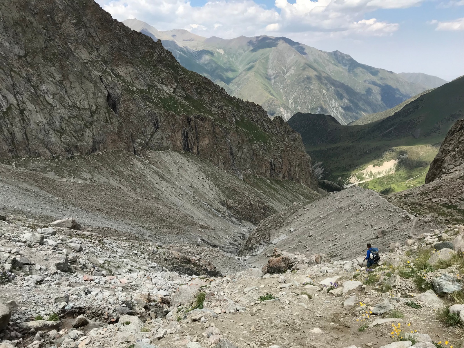
Our task for this day was to get back safely to our car. It meant we have to walk 22 kilometres. Firstly we had to cross the river again. It was 8 a.m. and water was very cold, so it wasn't pleasant experience. It took us a while before we managed to find the best place for crossing, but when we did it went without any problems. First 3-4 kilometres were very easy and we were surprised how fresh we felt. However exhaustion hit us very soon, we felt like having no energy and every kilometre seemed endless. Moreover it was getting very hot.
When we reached half of the way, the terrain became easier for our legs and we were able to go faster. We couldn't stop for a long time because our legs really hurt. We reached our car with first raindrops. We made it! 3 days, 58 kilometres, 1700 metres of ascent and the same of descend.
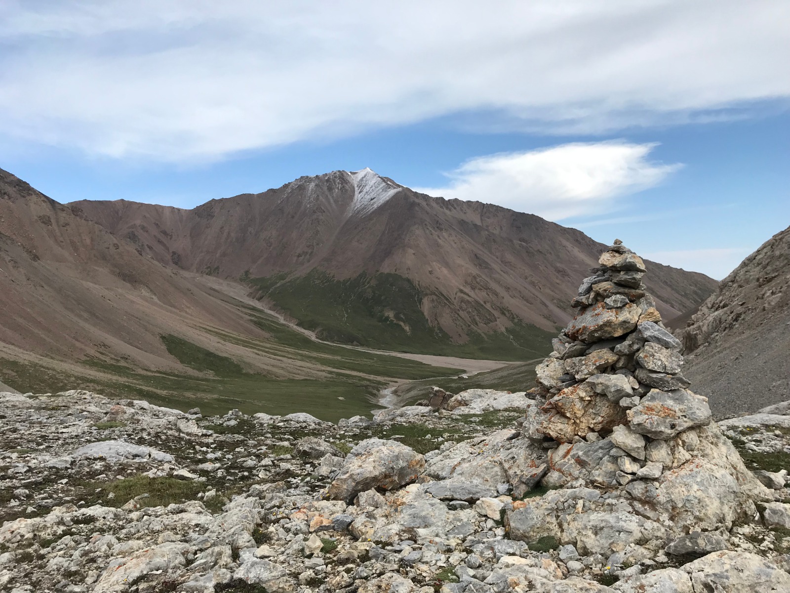
It was not as late so we decided to try to overcome mountain pass on the way back to Karakol and find some place to sleep in wide valley behind the pass. Military check went without any problems as was overcoming Chon-Ashu pass. We got to wide valley pretty soon and found place to set up our camp by small stream. Two dogs used our car as shelter before coming storm. We gave them something to eat and they were guarding us with grazing horses all night. Luckily storm avoided us, so we were able to enjoy calm night.
DAY 15-16 - Karakol, travelling to Bishkek
When we were leaving the valley in the morning our dog guards didn't want us to leave and they were howling and barking. Our first stop in Karakol was Cafe Dastorkon when we wanted to have a lunch. Food and drinks disappeared very quickly in our stomachs. It seemed like we hadn't eaten for ages. We picked up big cappuccinos to go in our favourite Lighthouse Karakol and hit the road. We wanted to take the highway on the northern shore of Issyk Kul. Unfortunately there were some construction works going on the highway and we had to take quite long and annoying detour before we were able to join the highway again.
We wanted to sleep on the shore of Issyk Kul. We found some place on the map and it was suitable for our needs. There were a lot of mosquitos and the place was little wet, but we were back in civilization again, so there were not many options. We took quick and cold dip in the lake, when it started to rain. There was a loud music from some disco on the shore of the lake reminding us we were not in the mountains anymore.
Loud howling of some animal close to our tent woke us up during the night and we put our dirty dishes to car just in case. The European mantis was looking at us from the top of our tent in the morning. We were leaving for final part of our trip back to capital city Bishkek. We had first incident with local police. They stopped us on the highway and made us undertake alcohol test. But they didn't let me blow it properly and after that, they claimed that it showed some alcohol in my blood. It wasn't true, because I had not been drinking any alcohol for at least 10 days. They put us in their car and told us I have to undertake some blood test in the hospital. They were asking us many questions and finally they decided that everything is okay and they took us back to our car and let us leave. They probably expected we gave them some money that was the only explanation we figured out. We were very relieved, but upset as well.
Next problem was in Bishkek. Police stopped us again and claimed that we were driving in the wrong line. It was nonsense. The policeman wanted to give us 100 dollar fine. It was ridiculous. We told him we don't have any dollars and gave him some money in local currency and he let us leave. We had to calm down, so we went shopping to local souvenir shop One village one product. We returned our car and packed our stuff for tomorrow flight.
DAY 17 - flight from Bishkek to Prague via Istanbul
We had very early flight from Bishkek airport to Istanbul, so we took a taxi to the airport. Our flight to Istanbul was without any problems. However flight from Istanbul to Prague was delayed. There was a big traffic at airport in Istanbul.
We arrived back to Prague to traditional warm welcome at the airport. We were pretty tired. We walked around 128 kilometres, ascended 4 724 metres and descended 4 709 metres. That was some portion in higher altitude. When we forget problems with police, it was one of our best mountain expeditions and our first 4 000 metres mountain was awesome experience.